The Sailing Vessel Apropos
Desolation Sound Trip
Aug. 28 - Sept. 18, 2010
Destination: Desolation Sound
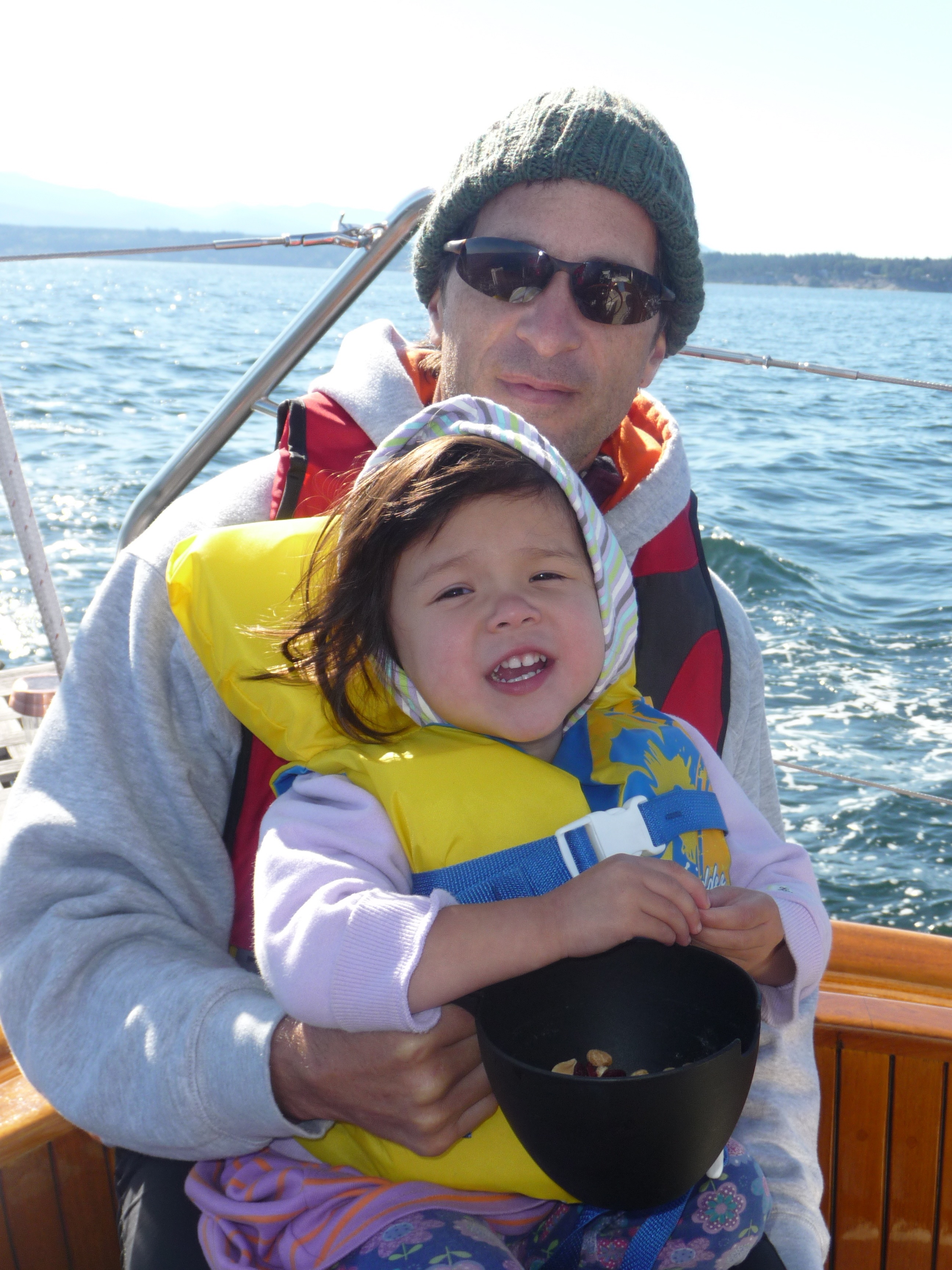
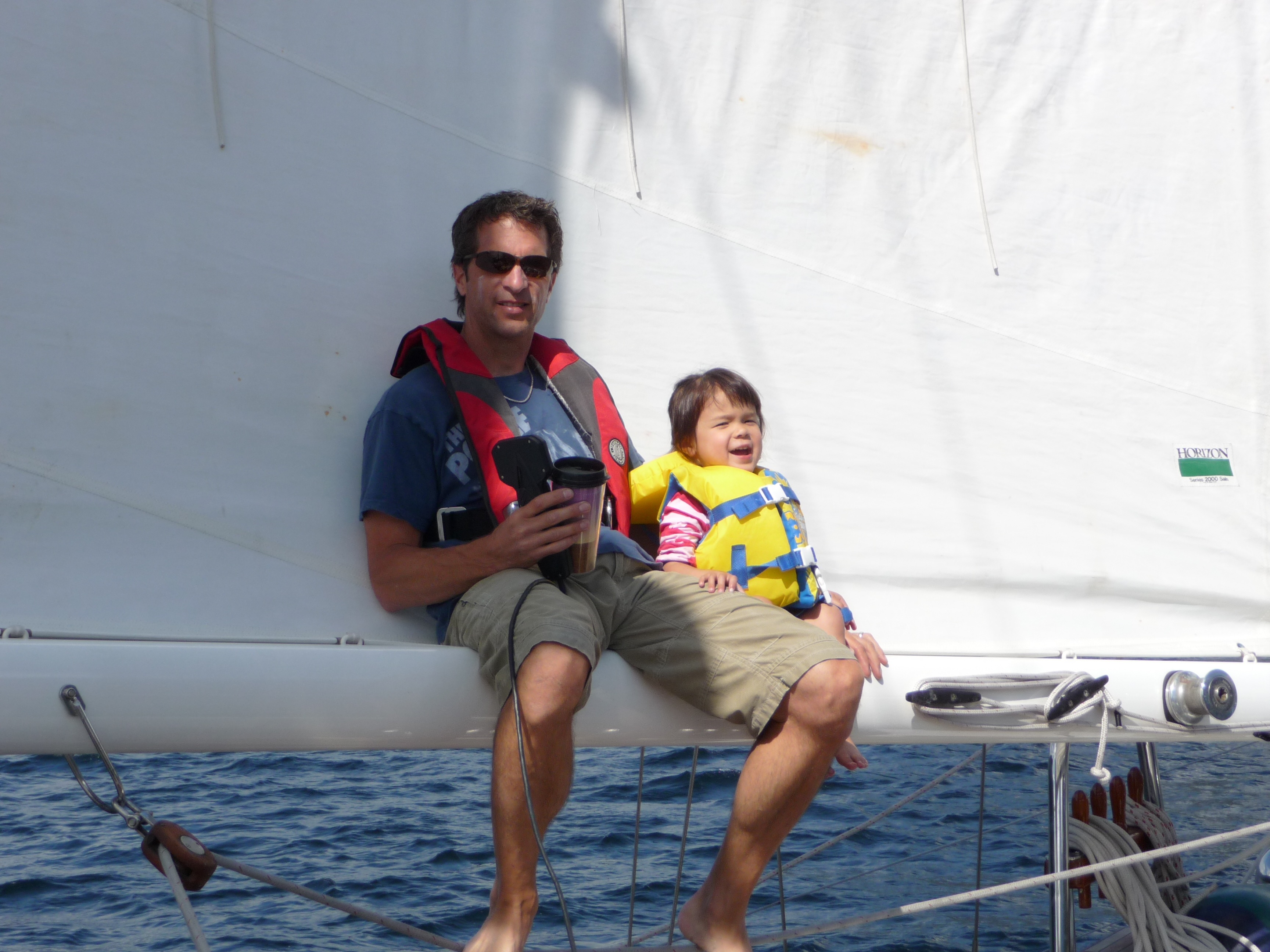
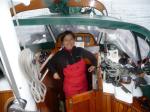
Crew: Jim, Karen, Jacintha
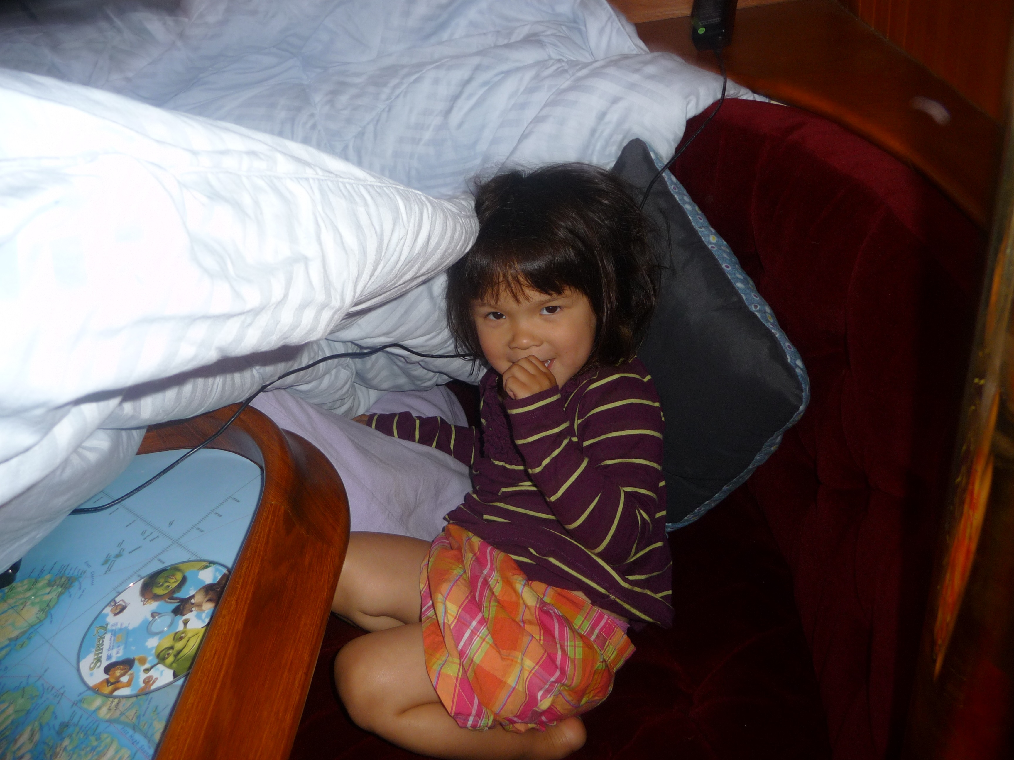
Since we had 3 weeks for this year's trip, we decided to go as far north as Desolation Sound. The plan was to make lots of stops along the way and spend about 5 days in Desolation Sound, then make the return trip to Seattle (about 250 miles) in 5 days. We planned to visit some new ports including Victoria, Vancouver and Nanaimo. Most of the sailing will be in more remote areas such as Jervis Inlet and Desolation Sound. Crew is Karen and Jacintha (who is 3-1/2 and has been sailing since she was 4 months old) from Seattle to Victoria, then picking up Sherman and Kim (Karens parents) for the Victoria to Nanaimo leg, then just the three of us from there to Desolation Sound and back. The total trip will be almost 700nm, about twice as far as we have ever been on Apropos.Day
1: Lake Union to Port Townsend (47nm)
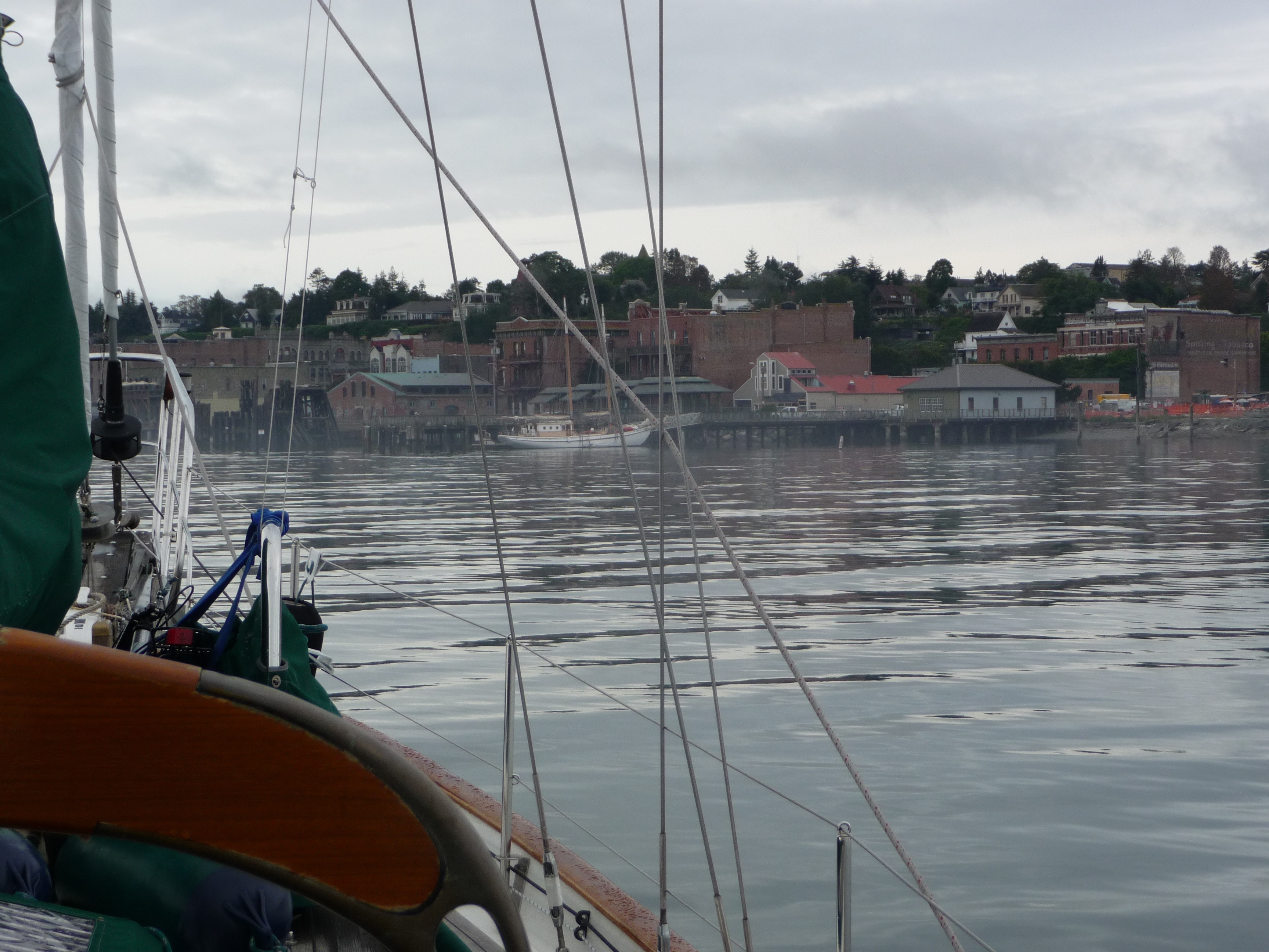
Departed Lake Union at 7:30am and topped off the tanks with 32 gallons of diesel at Ballard Oil. We had about a 45 minute wait at the Ballard Locks and tied up to a pier while waiting. High tide was at noon so we had positive current most of the day. It was a chilly sail into a 15 knot northerly with mostly cloudy skies. Motor-sailed most of the way and reached Port Townsend around 7pm and anchored out in the bay.
Day 2: Port Townsend to Victoria (32nm)
Up-anchored and got
an early start
to take advantage of the ebb tide, which was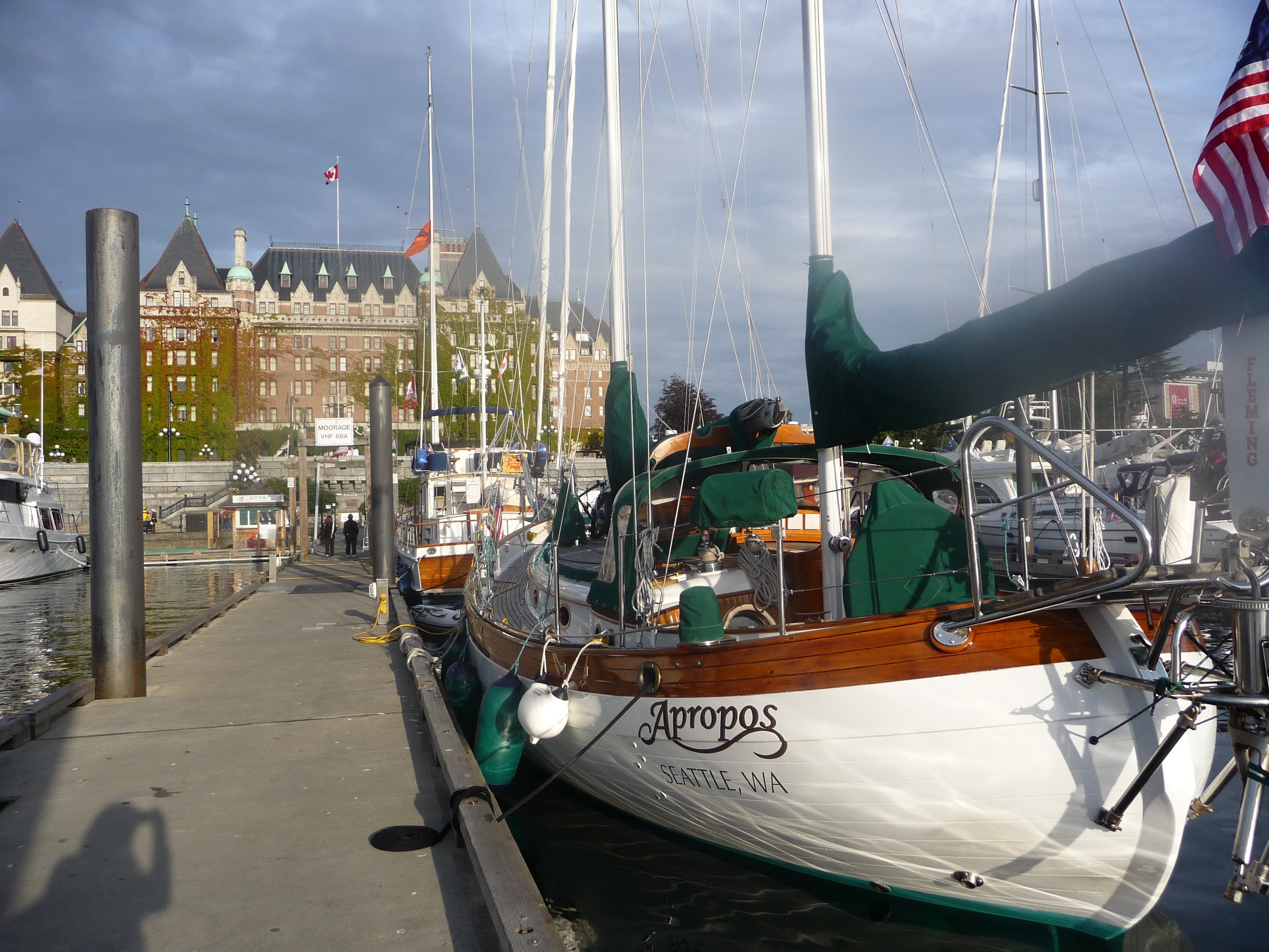 5
5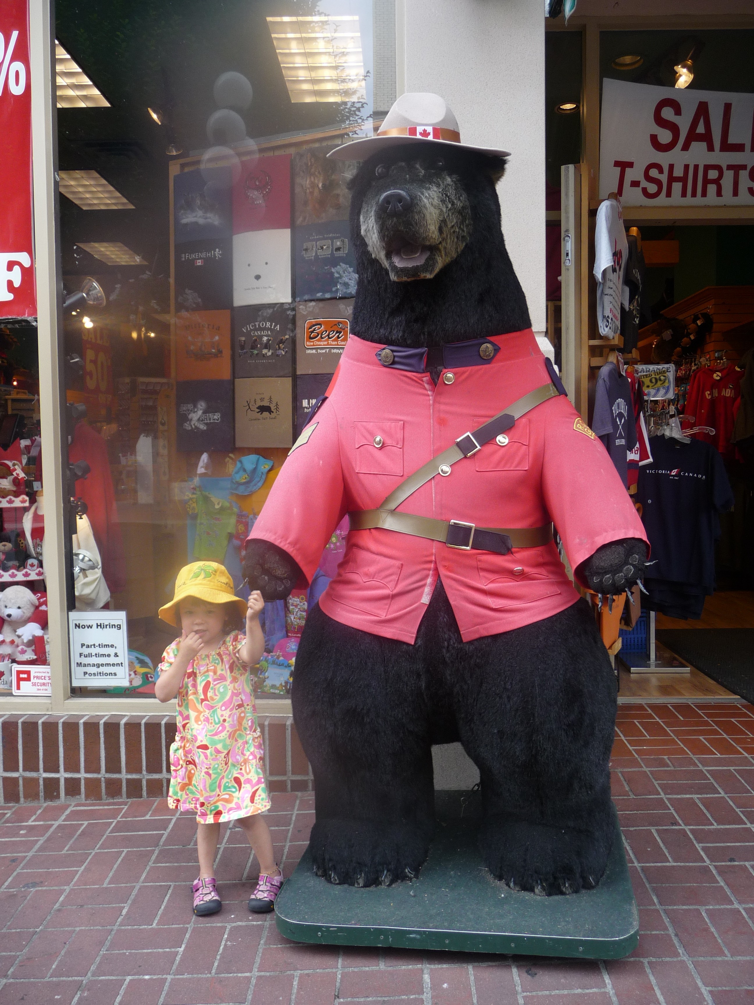 knts
flowing out of Admiralty Inlet. Motored across the
Strait of Juan de Fuca on flat water (we would find out about a week
later that some boats were lost
crossing this strait when bad weather went through the area).
After clearing customs in Victoria Harbor, we docked at the
marina right in front of the Empress Hotel. Met up with
Sherman and Kim, who were visiting us from Australia and came up from
Seattle aboard the Victoria Clipper (a fast hydroplane that takes about
3 hours). We actually waved to them as they passed us
somewhere between Seattle and Port Townsend. After getting
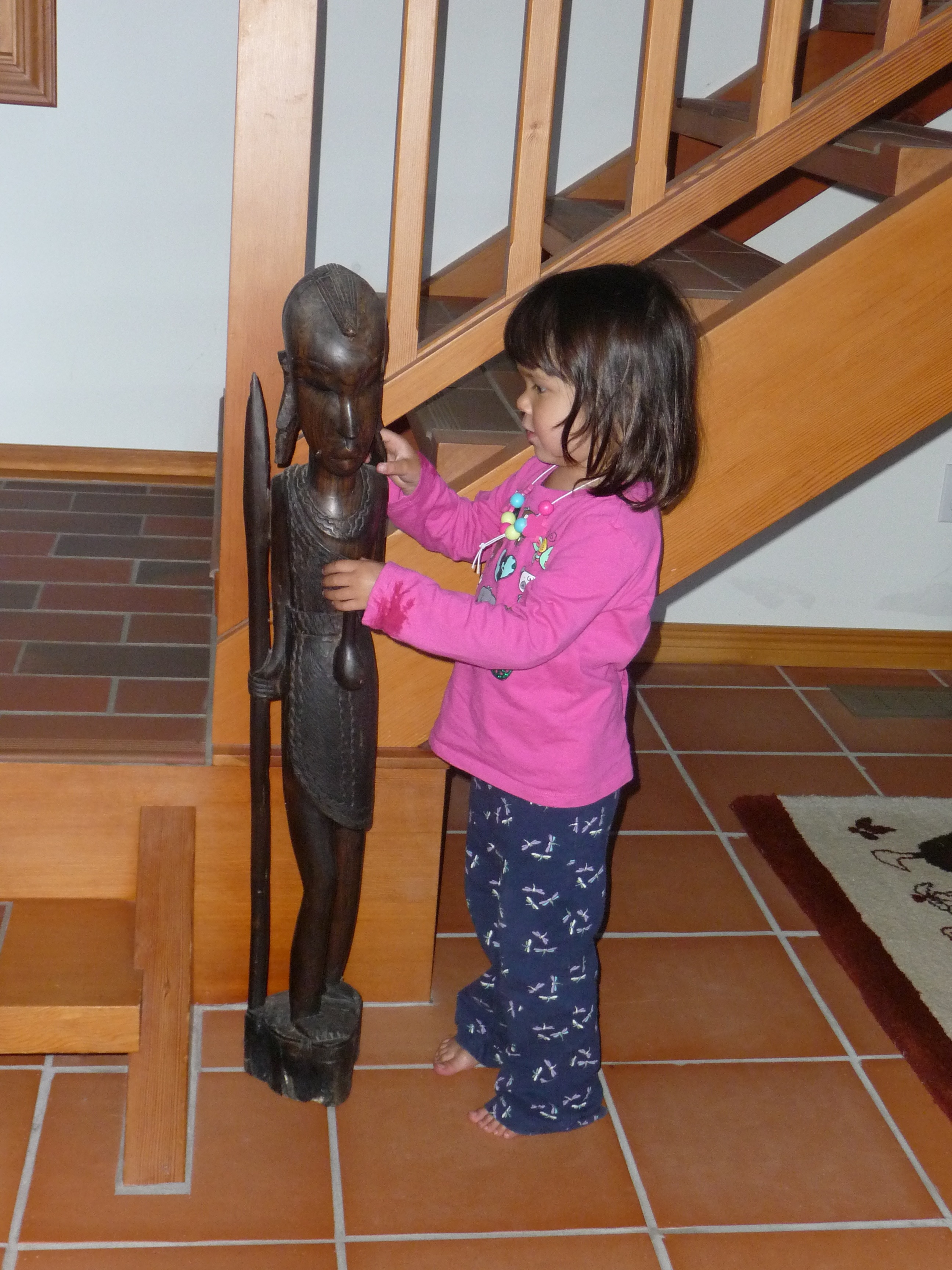
their luggage on board, we walked around town where Jacintha met a
friendly bear, then went out for dinner. .
knts
flowing out of Admiralty Inlet. Motored across the
Strait of Juan de Fuca on flat water (we would find out about a week
later that some boats were lost
crossing this strait when bad weather went through the area).
After clearing customs in Victoria Harbor, we docked at the
marina right in front of the Empress Hotel. Met up with
Sherman and Kim, who were visiting us from Australia and came up from
Seattle aboard the Victoria Clipper (a fast hydroplane that takes about
3 hours). We actually waved to them as they passed us
somewhere between Seattle and Port Townsend. After getting
their luggage on board, we walked around town where Jacintha met a
friendly bear, then went out for dinner. .
Day 3: Victoria to Saltspring Island (46nm)

 With
a long day ahead of us, we got a 7am start to catch positive currents
up Haro Strait. Winds were light so we motored north along
San Juan Island. As we reached the north end of San
J
With
a long day ahead of us, we got a 7am start to catch positive currents
up Haro Strait. Winds were light so we motored north along
San Juan Island. As we reached the north end of San
J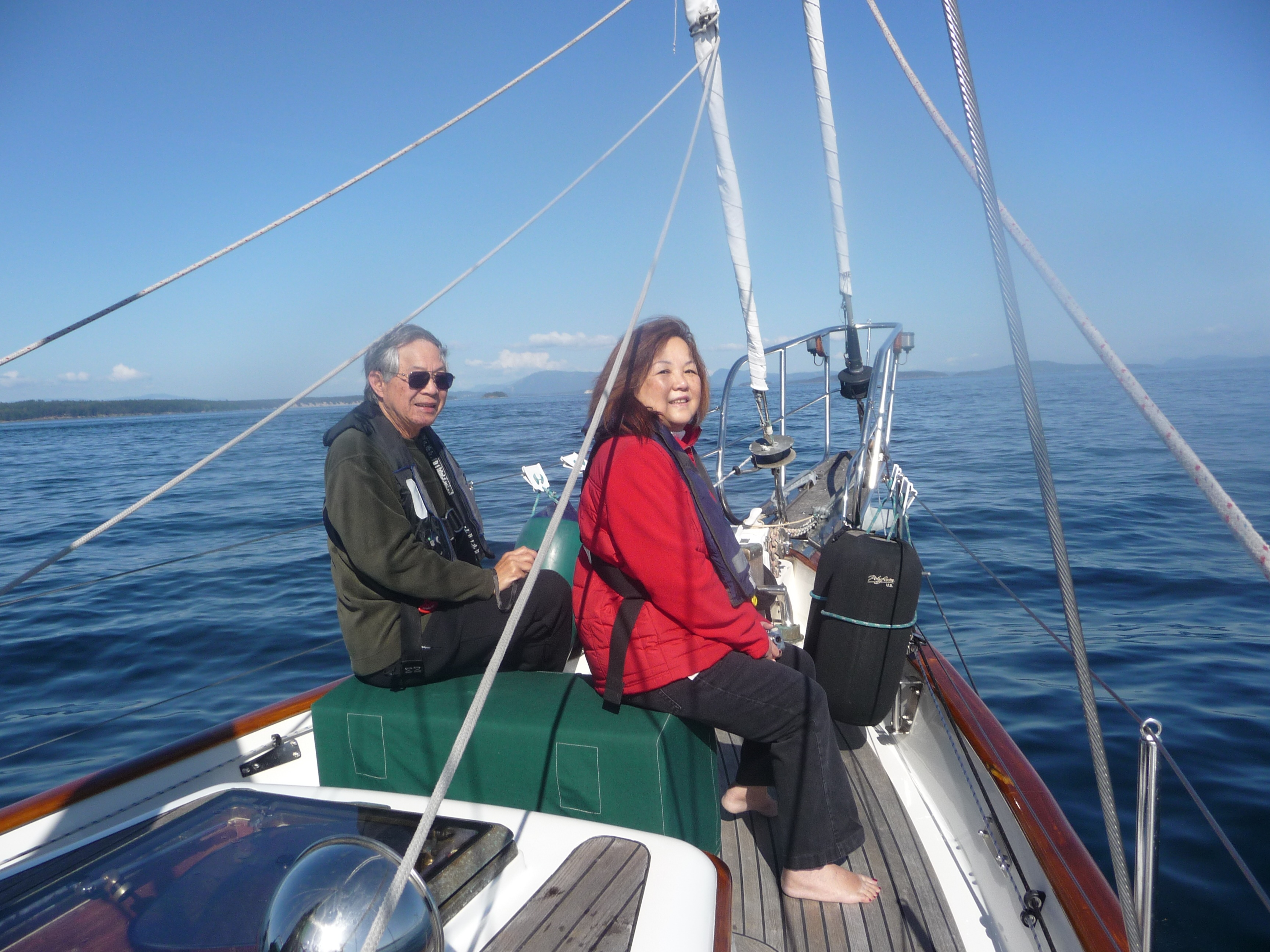 uan
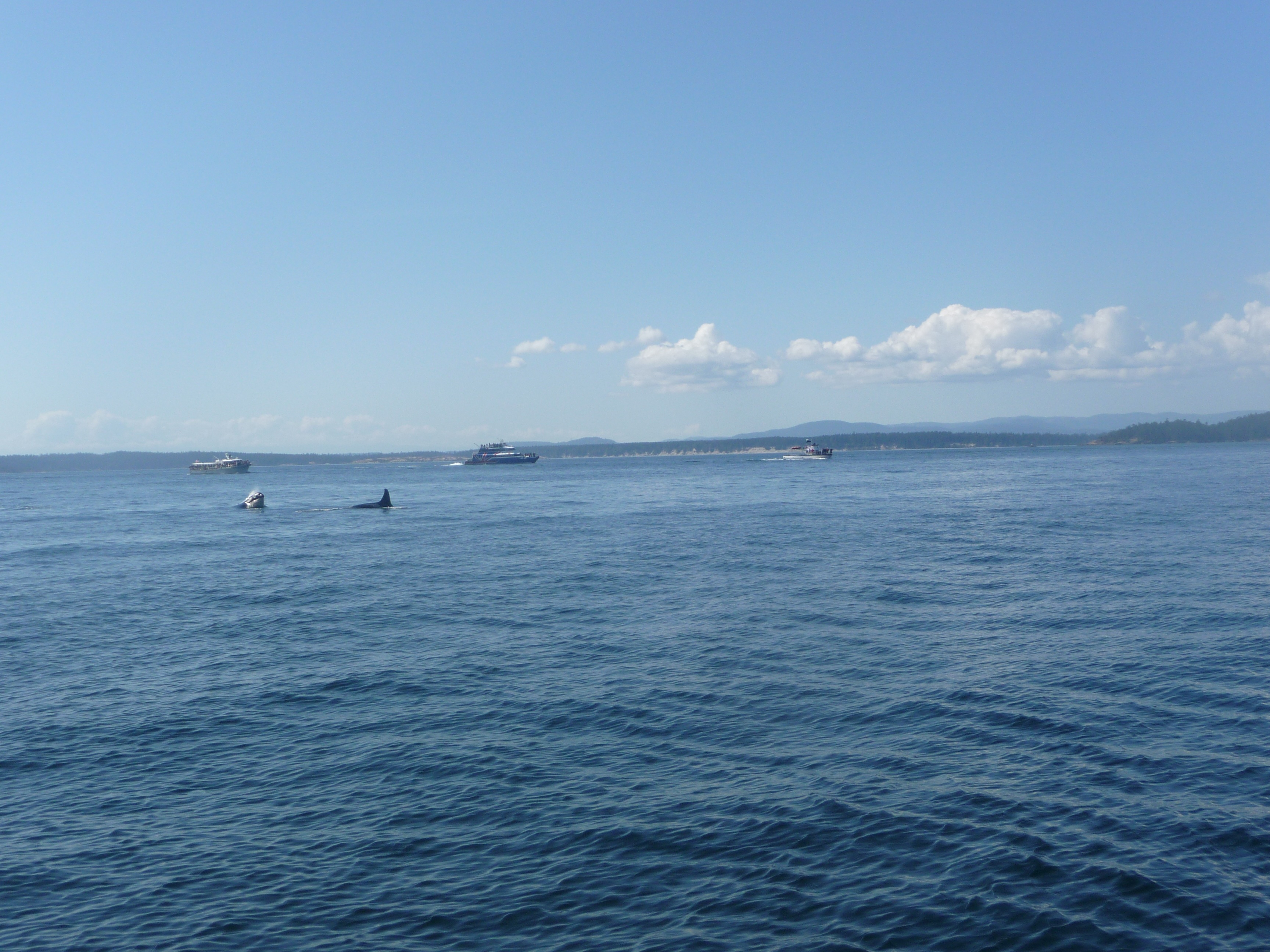
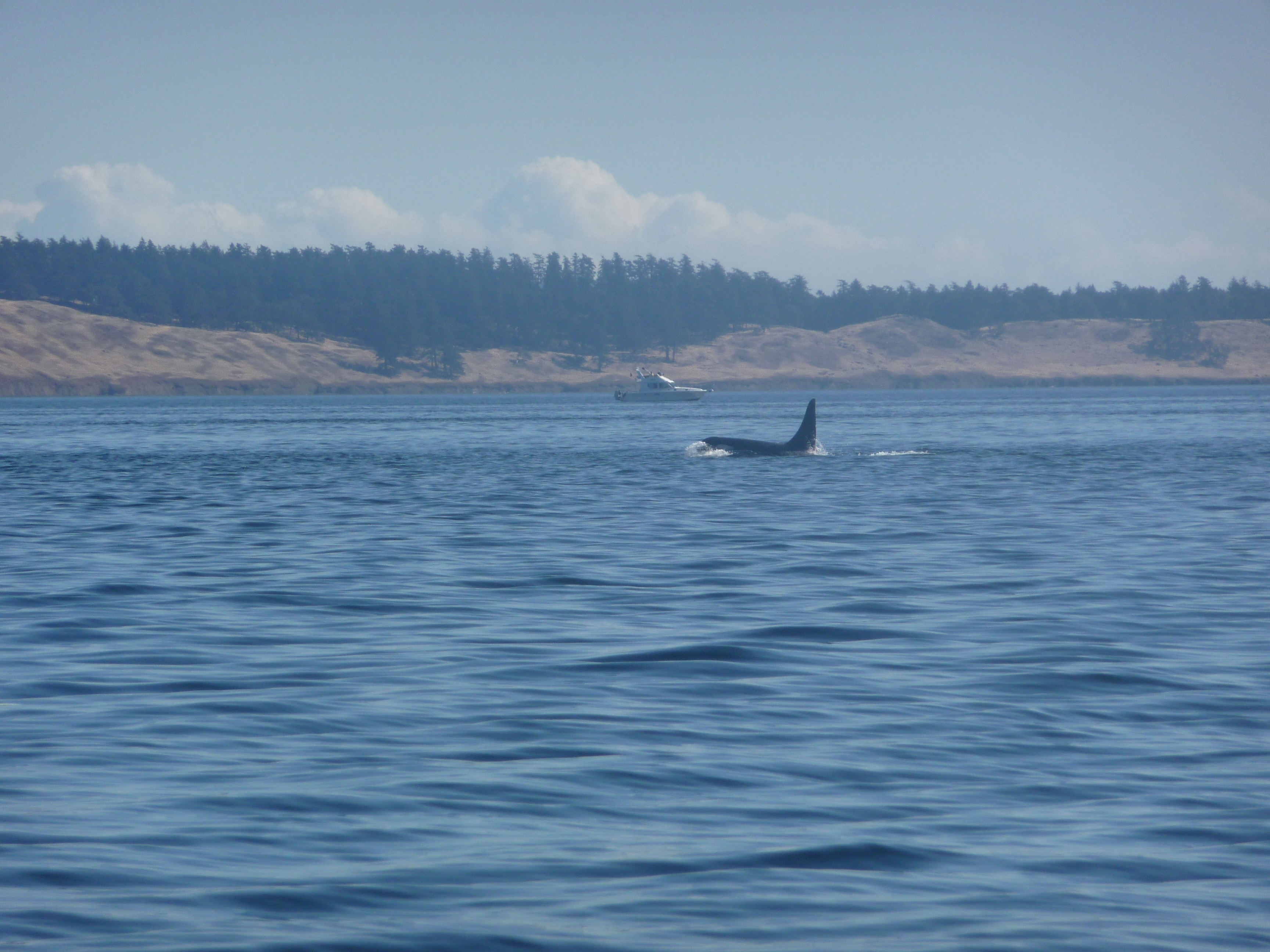
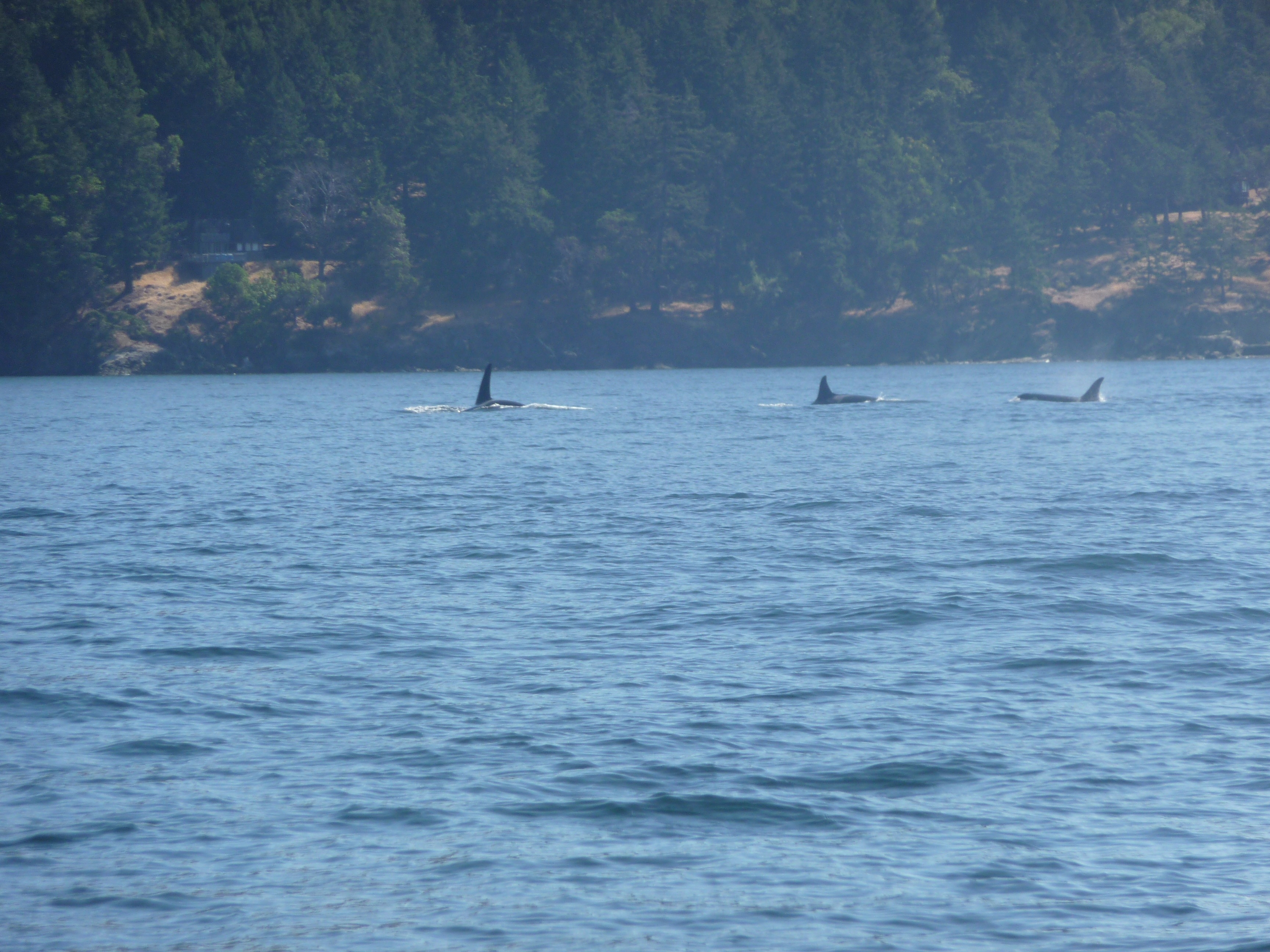
Island, a couple of whale watching boats sped by--a positive sign that
whales were spotted north of us. When we caught up to
them, we were treated to the best whale show we had ever seen.
For about 2 hours, we drifted along side of several pods of
Orca Whales, some getting as close as 25 yards (we promptly shut down
the engine and drifted with the current). It was a real treat
for Sherman and Kim, who had never sailed before. We saw so
many whales that Jacintha became disinterested after awhile (oh, just
another whale...).
Continued north and eventually docked at a marina at Ganges on
Saltspring Island where we would stay for two days before
heading further north.
uan
Island, a couple of whale watching boats sped by--a positive sign that
whales were spotted north of us. When we caught up to
them, we were treated to the best whale show we had ever seen.
For about 2 hours, we drifted along side of several pods of
Orca Whales, some getting as close as 25 yards (we promptly shut down
the engine and drifted with the current). It was a real treat
for Sherman and Kim, who had never sailed before. We saw so
many whales that Jacintha became disinterested after awhile (oh, just
another whale...).
Continued north and eventually docked at a marina at Ganges on
Saltspring Island where we would stay for two days before
heading further north.
Day 4: Saltspring Island (Ganges)
It rained overnight
and most of the
day. Jacintha had fun feeding the white swan who was ha nging
around the dock along with a couple of ducks. Had a relaxing
day walking around Ganges, drinking coffee, and shopping. Got
out the new folding bike and rode it around town. Had a nice
dinner at Auntie Pestos near the marina. Re-provisioned the
boat at the Ganges grocery store, a short walk from the marina.
nging
around the dock along with a couple of ducks. Had a relaxing
day walking around Ganges, drinking coffee, and shopping. Got
out the new folding bike and rode it around town. Had a nice
dinner at Auntie Pestos near the marina. Re-provisioned the
boat at the Ganges grocery store, a short walk from the marina.
Day 5: Saltspring Island to Thetis Island (20nm)
Another day of
motoring since the
wind was light. Kim entertain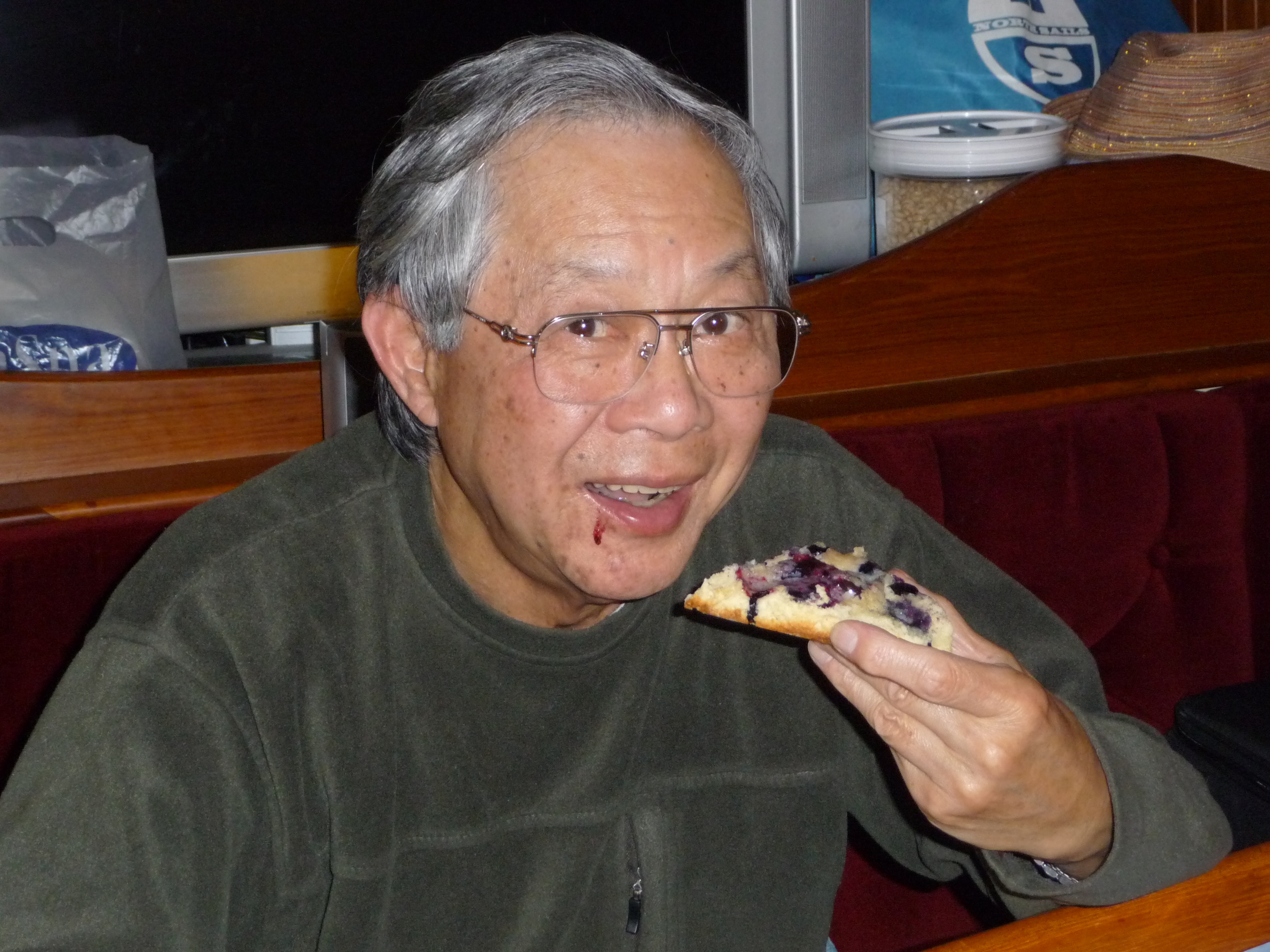 ed
Jacintha and dr
ed
Jacintha and dr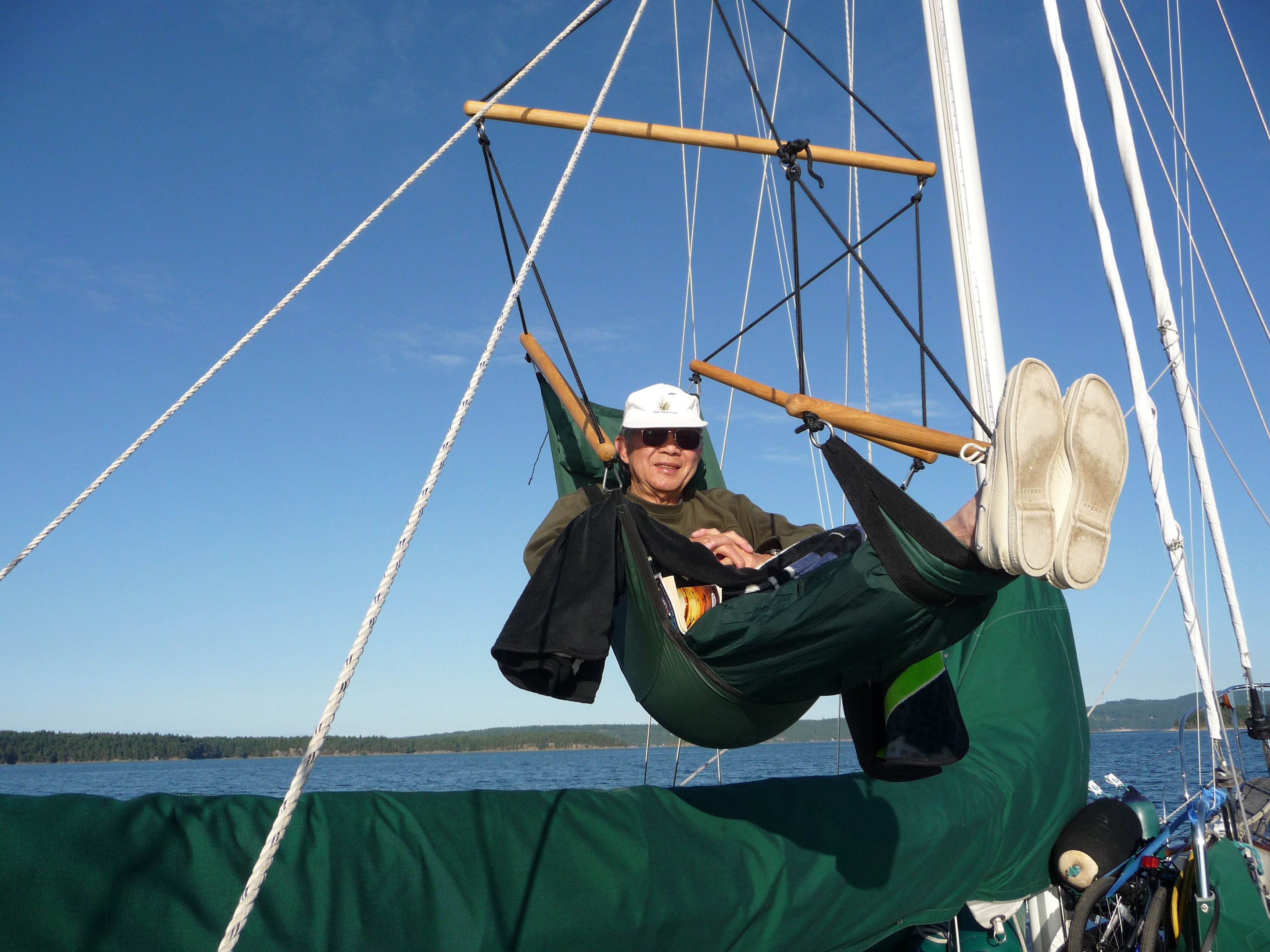 ew
ew
 a
little flower on her cheek with
a marker and was a good sport when Jacintha insisted on
returning the favor! We anchored in Clam Bay on the north side of
Thetis
Island, then
took the dinghy to a pub on the opposite side via a narrow channel
that
divides the island in two. Back at the boat, Karen made fantastic
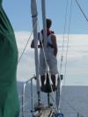
blueberry scones while Sherman relaxed in the halyard chair and
Cap'n 'Shiny Brass'
polished the brass ports and binnacle. Set the new and
improved crab trap, which folds up into an 18" diameter bag, near the
boat in 50' of water. There was only 1 other boat in the bay.
a
little flower on her cheek with
a marker and was a good sport when Jacintha insisted on
returning the favor! We anchored in Clam Bay on the north side of
Thetis
Island, then
took the dinghy to a pub on the opposite side via a narrow channel
that
divides the island in two. Back at the boat, Karen made fantastic
blueberry scones while Sherman relaxed in the halyard chair and
Cap'n 'Shiny Brass'
polished the brass ports and binnacle. Set the new and
improved crab trap, which folds up into an 18" diameter bag, near the
boat in 50' of water. There was only 1 other boat in the bay.
Day 6: Thetis Island to Nanaimo (17nm)
Pulled the crab pot
up after we
up-anchored and drifted along side the floating buoy. Caught
3 crabs but all were too small to keep. The weather was sunny and
warm as we
continued sailing north. We read a lot about
Dodd Narrows, where currents can exceed 15 knots, and you have to time
your arrival
near slack tide. We arrived a bit ahead of schedule and
waited at
the south entrance for about 30 minutes before
motoring through with about 2 knots of positive current. The
narrows is a dogleg right followed by a dogleg left and boats entering
either end are supposed to broadcast a Securite on VHF channel 16,
which we did. Cap'n 'White Knuckles'
proceeded cautiously and for a second could have sworn he
spotted a long barge approaching from the other end, but turned out to
be something on the shore! From there it was a short distance
to Nanaimo. We radioed ahead and got a moorage slip at the
city marina. As we approached the slip, two people on shore
called out my name. They were a couple I had met 6 months
earlier in Seattle who were looking for
for  a
Hans Christian
a
Hans Christian  and
wanted to
see
and
wanted to
see 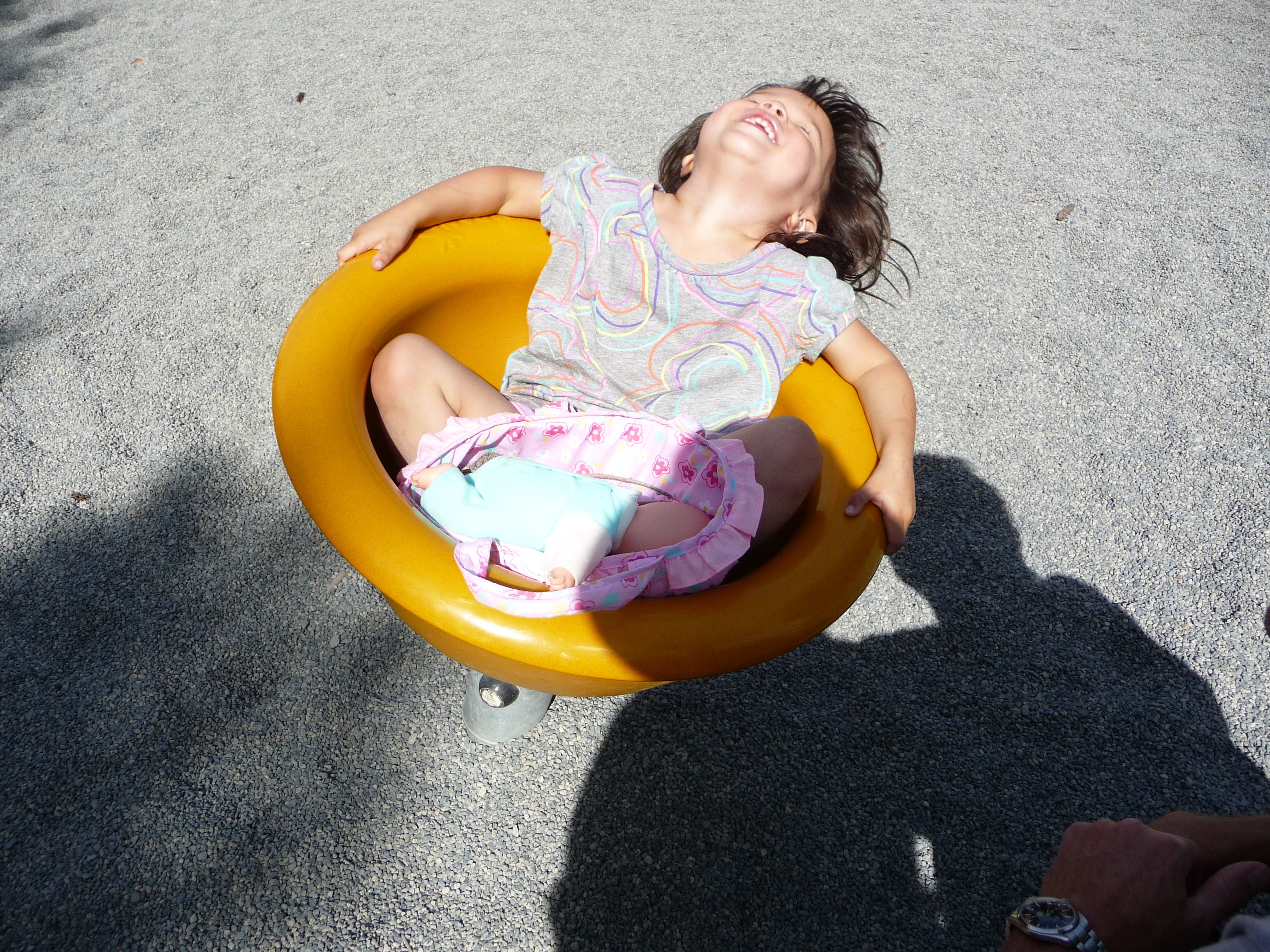 Apropos
to get an idea what they are like. Lance and
Carol just happened to live along the water side of Nanaimo
and just
happened to be home as we were approaching and just happened to look
out the
window at the right time to spot us! After tying up,
we made plans
to go to their condo later for dinner (they even insisted
we bring our laundry over and use their washer/dryer). It was
hot and sunny so we walked along the waterfront, had ice cream, and
then found a huge playground where Jacintha had a lot of fun climbing,
swinging and spinning. Later that evening we went to the
condo where Lance and Carol lived (just a 5 minute walk from the
marina) and had a lovely evening and a great steak dinner with a bottle
of Syrah wine. Note--Lance and Carol have since bought their
Hans Christian (aptly named s/v Syrah) .
Apropos
to get an idea what they are like. Lance and
Carol just happened to live along the water side of Nanaimo
and just
happened to be home as we were approaching and just happened to look
out the
window at the right time to spot us! After tying up,
we made plans
to go to their condo later for dinner (they even insisted
we bring our laundry over and use their washer/dryer). It was
hot and sunny so we walked along the waterfront, had ice cream, and
then found a huge playground where Jacintha had a lot of fun climbing,
swinging and spinning. Later that evening we went to the
condo where Lance and Carol lived (just a 5 minute walk from the
marina) and had a lovely evening and a great steak dinner with a bottle
of Syrah wine. Note--Lance and Carol have since bought their
Hans Christian (aptly named s/v Syrah) .
Day 7: Nanaimo to Pender Harbor (40nm)
Sherman and Kim had
reservations to
take a bus from Nanaimo to Victoria, then the Victoria Clipper back to
Seattle where they would fly out to get back to Australia.
Since the bus didn't leave until 1pm, I invited Lance and Carol
to go
for a sail around Nanaimo harbor. Unfortunately, there was
little wind but we did manage to get three sails up and ghost along
before motoring back to the marina. After re-provisioning at a
local grocery store, we said our goodbyes and Lance and Carol
drove them to the bus depot. We had a long sail ahead of us
and didn't want to be out in the Strait of Georgia at dark, so we
quickly untied the boat and motored north-east. There was a
strong wind advisory for the Strait of Georgia, but we saw only light
wind and motor-sailed for the next 7 hours. We spotted Pender
Harbor at sunset  and
by the time we reached the anchorage well inside the harbor it was
dark. Choosing the right spot to anchor is always a bit
tricky because you have to take into consideration tidal changes (don't
want to end up on the rocks after the tide goes out), scope (how much
chain you let out vs the depth
of the water), wind & current (full keel sailboats sometimes swing
with respect to the currents vs the wind), and of course,
location (don't want to bump into another anchored boat in the middle
of the night). It's this last one that usually causes Cap'n 'I think
this is a good
spot'
and Co-Cap'n 'No you moron, we're too
close to that boat' to
argue. Throw in the wild card of Darkness, and it can get
very exciting (or entertaining if you happen to hear us from a near-by
boat). So we ended up anchoring, then up-anchoring, then
re-anchoring in what was believed to be a better spot, only
to find out it was similar to where we were the first time!
Fortunately there was no mutiny that night (and the anchorage
was fine).
and
by the time we reached the anchorage well inside the harbor it was
dark. Choosing the right spot to anchor is always a bit
tricky because you have to take into consideration tidal changes (don't
want to end up on the rocks after the tide goes out), scope (how much
chain you let out vs the depth
of the water), wind & current (full keel sailboats sometimes swing
with respect to the currents vs the wind), and of course,
location (don't want to bump into another anchored boat in the middle
of the night). It's this last one that usually causes Cap'n 'I think
this is a good
spot'
and Co-Cap'n 'No you moron, we're too
close to that boat' to
argue. Throw in the wild card of Darkness, and it can get
very exciting (or entertaining if you happen to hear us from a near-by
boat). So we ended up anchoring, then up-anchoring, then
re-anchoring in what was believed to be a better spot, only
to find out it was similar to where we were the first time!
Fortunately there was no mutiny that night (and the anchorage
was fine).
Day 8: Pender Harbor to Secret Bay (14nm)
Motored and
motor-sailed through
Agamemnon Channel. Was very choppy and gusty at the
entrance to the channel, but settled down somewhat further into the
long channel. At the end of Agamemnon Channel is Sachelt
Inlet to the south, and Jervis Inlet to the east. We sailed
about a mile down Sachelt Inlet to Secret Bay and docked at
Backeddy
Marina. After tying up, we drove the dinghy south for about
another mile,
then got ou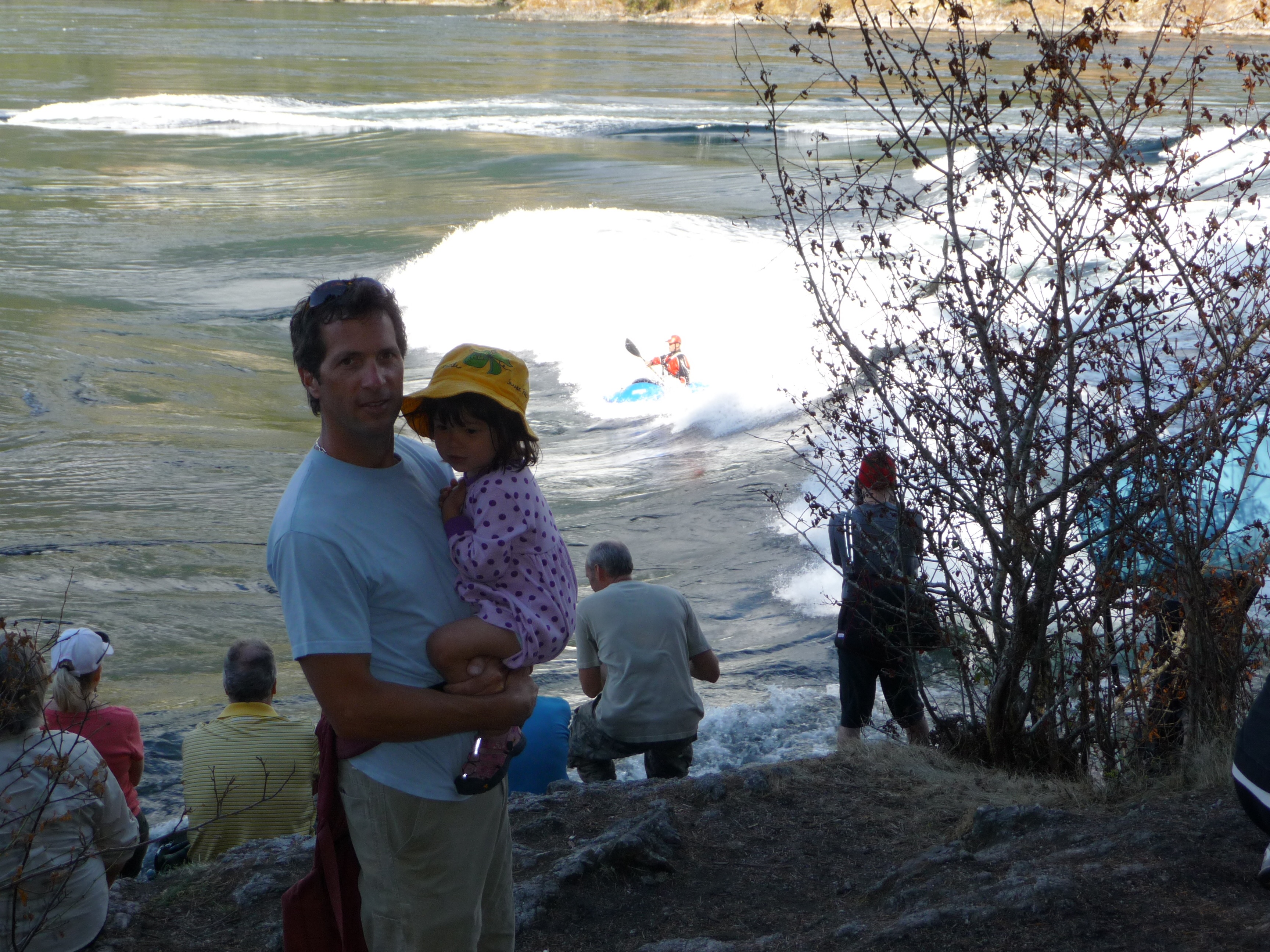 t
and
t
and 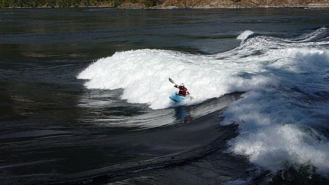 hiked
for 1 hou
hiked
for 1 hou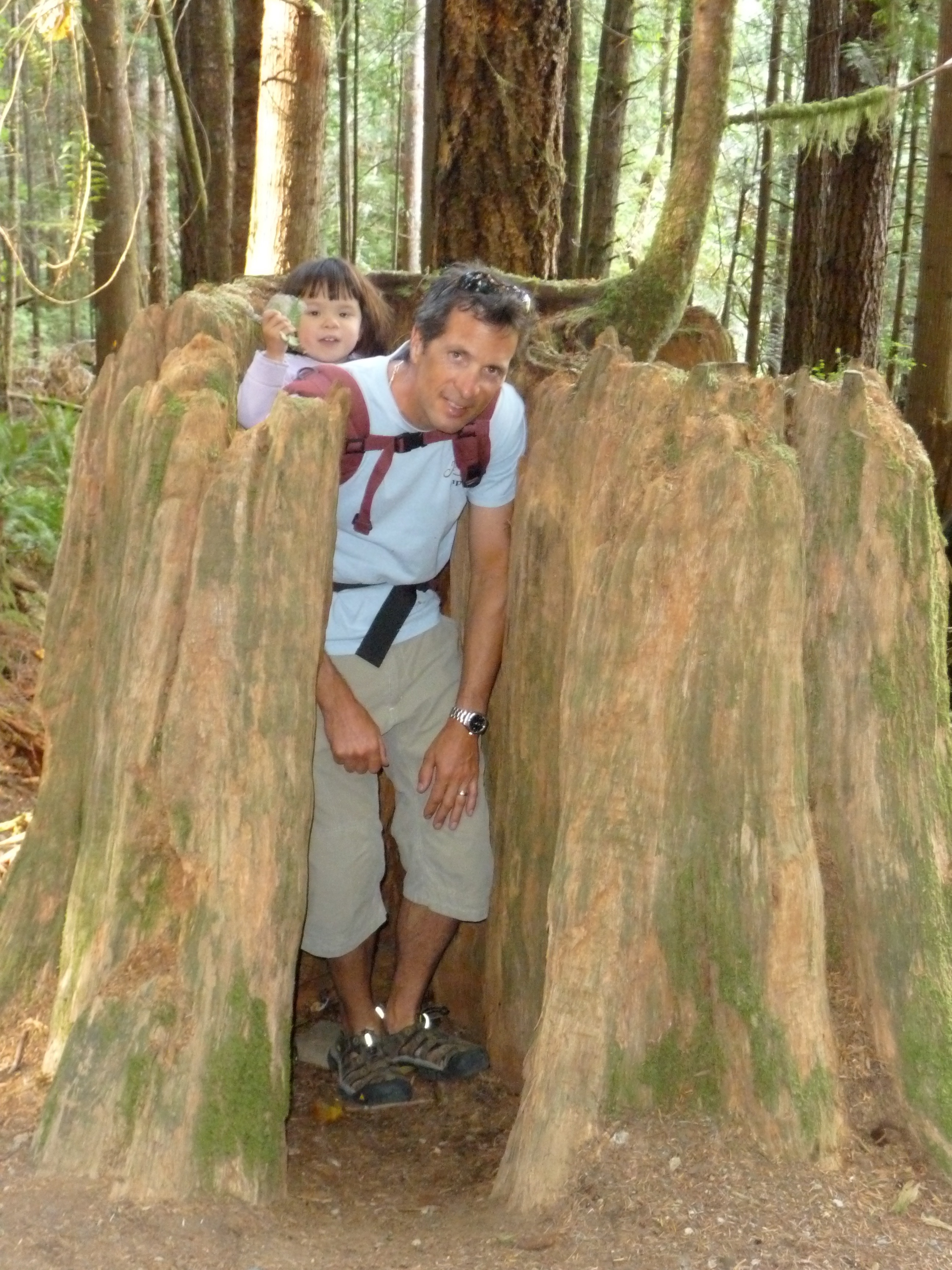 r
to Skookumchuc
r
to Skookumchuc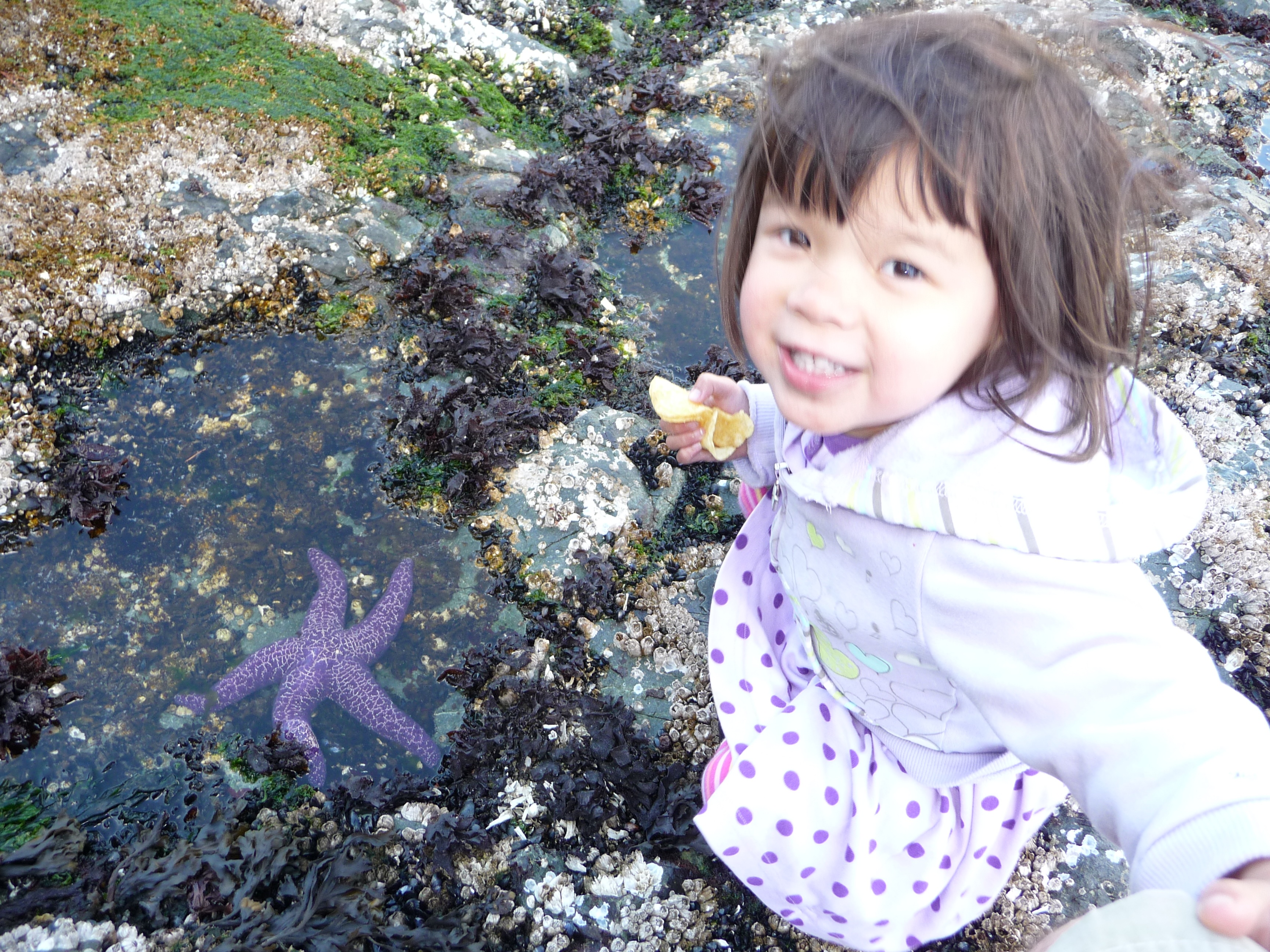 k
Narrows. We
arrived there
during max flood to see the kayakers surfing the 5' standing wave.
The wave is created by water rushing past a
submerged boulder near the shore to form a back-eddy.
Kayakers enter the water upstream a bit, then drift backwards
until they enter the standing wave, then they paddle just the right
amount to keep them pointing forward and atop the standing wave.
The better ones could stay there for a long minute before
tiring out and letting the current take them beyond the wave to where
they could paddle to shore and hike back up to do it again.
There were also tour boats that took people there to see the
standing wave and kayakers. Even though the tour boat is away
from the standing wave, they have to point upstream and run their huge
engine full throttle just to stay stationary.
The mile hike back to the dinghy took a long time since
Jacintha and I like to explore things like tree stumps. Back
at the marina, we ate the famous Skookumchuck Burgers at the marina
pub. Jacintha collected a purple starfish in a bucket.
We heard the water at this marina was excellent so we took
the opportunity to fill the water tanks as well as the gas can used in
the dinghy.
k
Narrows. We
arrived there
during max flood to see the kayakers surfing the 5' standing wave.
The wave is created by water rushing past a
submerged boulder near the shore to form a back-eddy.
Kayakers enter the water upstream a bit, then drift backwards
until they enter the standing wave, then they paddle just the right
amount to keep them pointing forward and atop the standing wave.
The better ones could stay there for a long minute before
tiring out and letting the current take them beyond the wave to where
they could paddle to shore and hike back up to do it again.
There were also tour boats that took people there to see the
standing wave and kayakers. Even though the tour boat is away
from the standing wave, they have to point upstream and run their huge
engine full throttle just to stay stationary.
The mile hike back to the dinghy took a long time since
Jacintha and I like to explore things like tree stumps. Back
at the marina, we ate the famous Skookumchuck Burgers at the marina
pub. Jacintha collected a purple starfish in a bucket.
We heard the water at this marina was excellent so we took
the opportunity to fill the water tanks as well as the gas can used in
the dinghy.
Day 9: Secret Bay to Princess Louisa Inlet (41nm)
Departed at 10am in
order to time the arrival at Malibu Rapids during high slack tide.
This was our first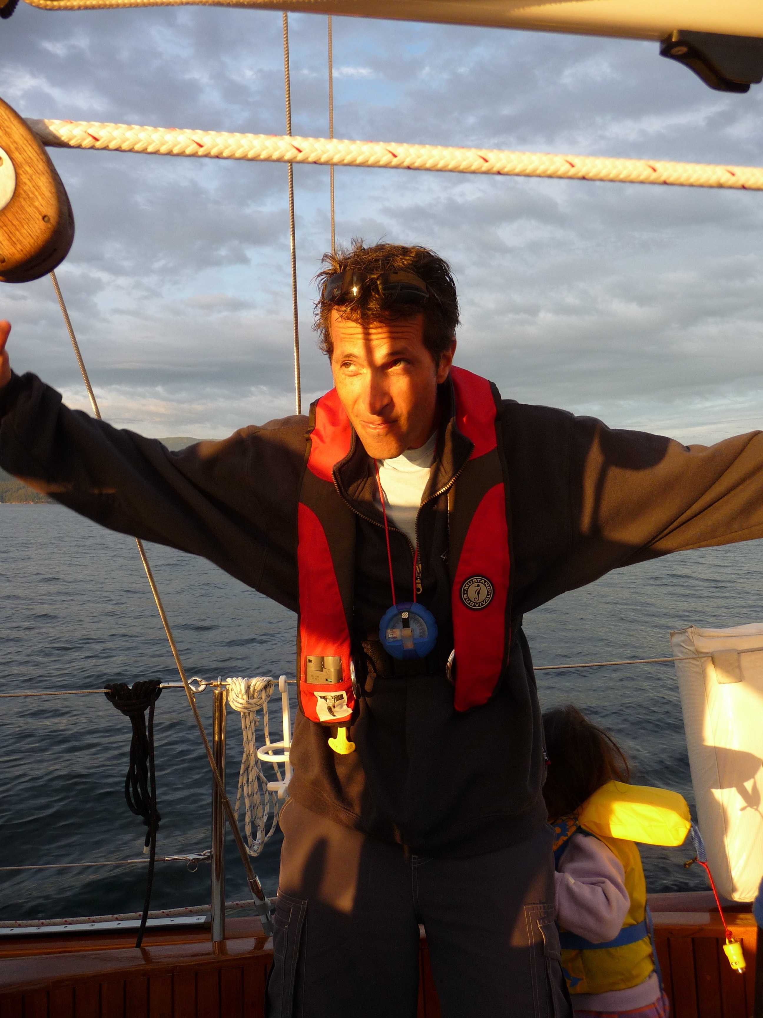 really GREAT day of sailing with a 10-20 knot
wi
really GREAT day of sailing with a 10-20 knot
wi nd
astern. Mu
nd
astern. Mu st
st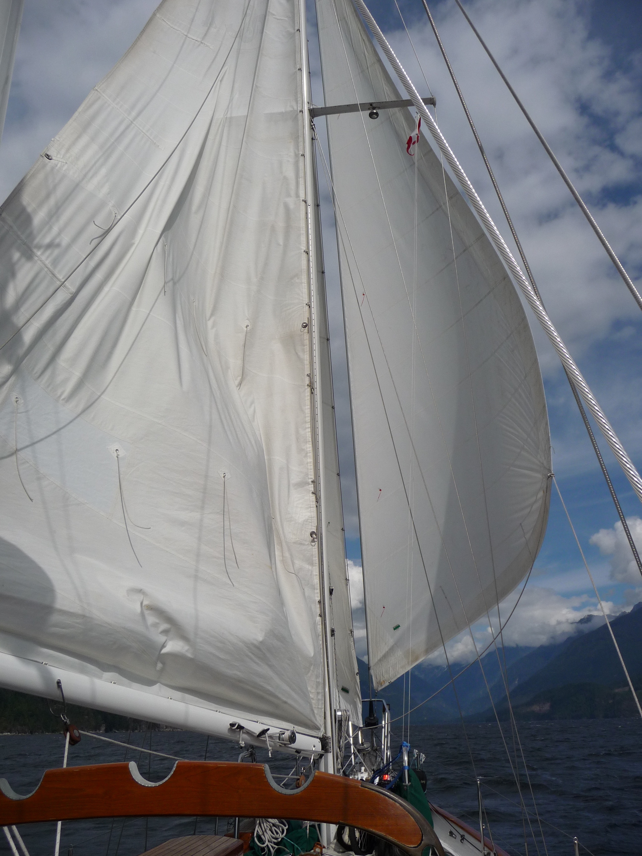 have been due to
Jacintha and I performing
the
Schookumchuck Dance in the
cockpit. If I had to pick my best
single day of
sailing ever, this would have to
be it. The scenery
in Jervis Inlet was amazing with the long, winding fjord that seemed to
go on forever. We were lucky to have the wind blowing up the
inlet and not down. Apropos was well balanced with the jib
and
main going wing and wing much of the way. We jibed a bit to
keep
the wind about 20 degrees off the stern and reached speeds of 8.5
knots. The geography was amazing with the huge steep cliffs
continuing down for a mile underwater. We arrived at Malibu
Rapids ahead of schedule so we got some extra sailing in just going
back
have been due to
Jacintha and I performing
the
Schookumchuck Dance in the
cockpit. If I had to pick my best
single day of
sailing ever, this would have to
be it. The scenery
in Jervis Inlet was amazing with the long, winding fjord that seemed to
go on forever. We were lucky to have the wind blowing up the
inlet and not down. Apropos was well balanced with the jib
and
main going wing and wing much of the way. We jibed a bit to
keep
the wind about 20 degrees off the stern and reached speeds of 8.5
knots. The geography was amazing with the huge steep cliffs
continuing down for a mile underwater. We arrived at Malibu
Rapids ahead of schedule so we got some extra sailing in just going
back  and
forth along the
and
forth along the
 entrance.
Malibu Rapids entrance is
somewhat tricky because it is very shallow and windy. High
slack
gives you a few extra feet of depth with minimal current, so it's
worth
waiting for. (Note: Captain George Vancouver sailed
all the
way up Jarvis Inlet and saw the small entrance at Malibu Rapids and
thought is was just a creek flowing out so he didn't bother entering
and therefore never got to see Princess Louisa Inlet). The
depth
sounder was showing depths of 5 feet (that means 5 feet below the
bottom of the keel) at the entrance. Seeing that can make any
captain a bit nervous! The channel is well marked with buoys
and
we also zoomed way in on the chartplotter for some assurance we were
turning at the correct points. After a few winding turns, it
opens up into a wide channel of water called Princess Louisa Inlet and
continues for about 5 miles. This is also a very steep and
high
walled inlet but is protected in all directions from severe weather so
is normally calm. We motored to the end where there is a
beautiful waterfall and a long wooden dock. When we arrived
there
were only 2 other boats there, so we tied up on the dock, then explored
the shoreline.
entrance.
Malibu Rapids entrance is
somewhat tricky because it is very shallow and windy. High
slack
gives you a few extra feet of depth with minimal current, so it's
worth
waiting for. (Note: Captain George Vancouver sailed
all the
way up Jarvis Inlet and saw the small entrance at Malibu Rapids and
thought is was just a creek flowing out so he didn't bother entering
and therefore never got to see Princess Louisa Inlet). The
depth
sounder was showing depths of 5 feet (that means 5 feet below the
bottom of the keel) at the entrance. Seeing that can make any
captain a bit nervous! The channel is well marked with buoys
and
we also zoomed way in on the chartplotter for some assurance we were
turning at the correct points. After a few winding turns, it
opens up into a wide channel of water called Princess Louisa Inlet and
continues for about 5 miles. This is also a very steep and
high
walled inlet but is protected in all directions from severe weather so
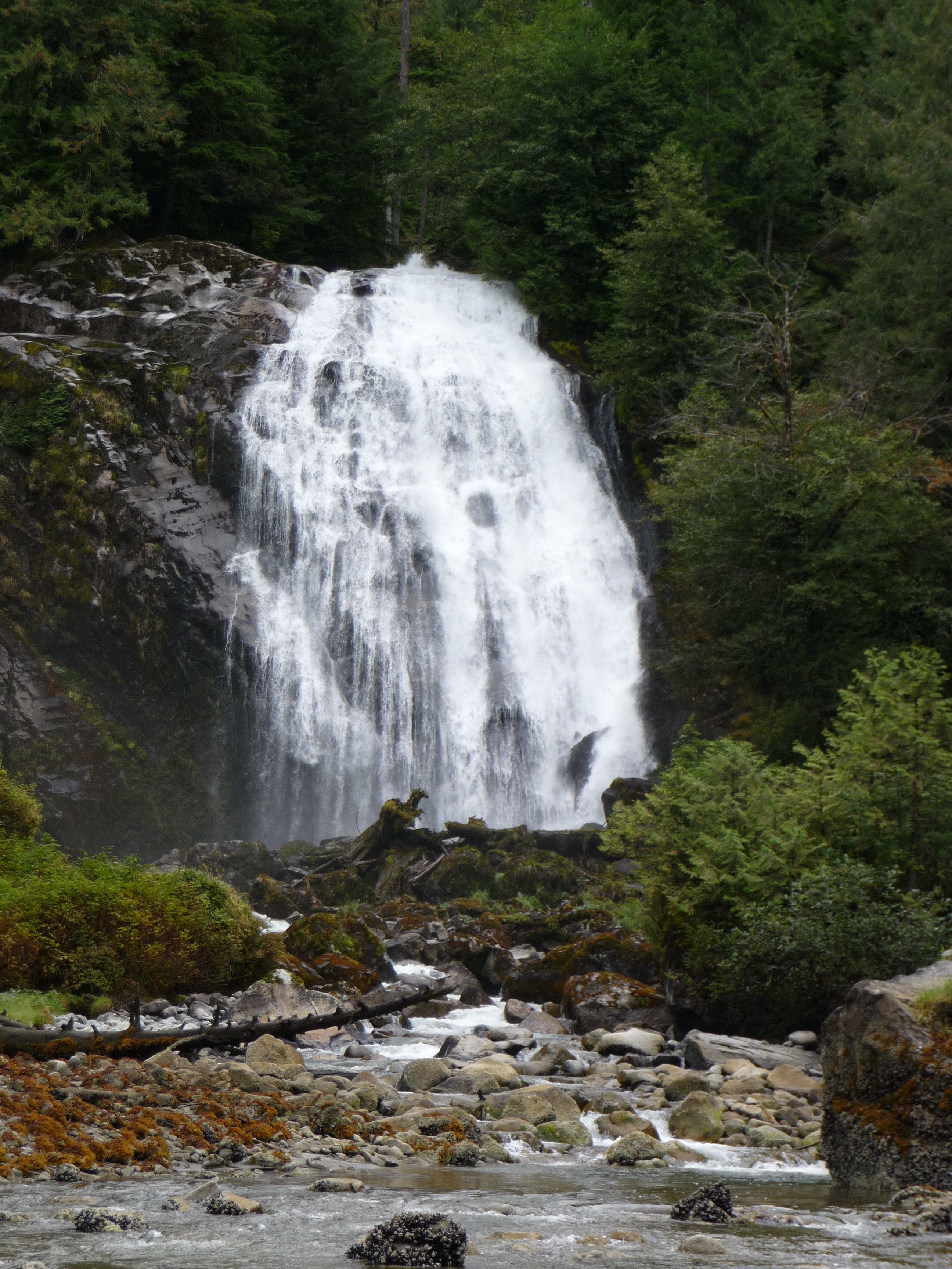
is normally calm. We motored to the end where there is a
beautiful waterfall and a long wooden dock. When we arrived
there
were only 2 other boats there, so we tied up on the dock, then explored
the shoreline.
Day
10: Princess Louisa Inlet


Rained overnight and
mostly
cloudy
weather
today.
Spent the day hiking
around the shoreline,
viewing
the waterfalls (tallest waterfall in N. America is here), examining
snails,
drinking
coffee, and just relaxing. Tried a hand at balancing rocks
ruk shuk style at the base of
Chatterbox Falls. Had to
explain to Jacintha that it was not nice to knock them over for fun.
A park ranger is stationed here
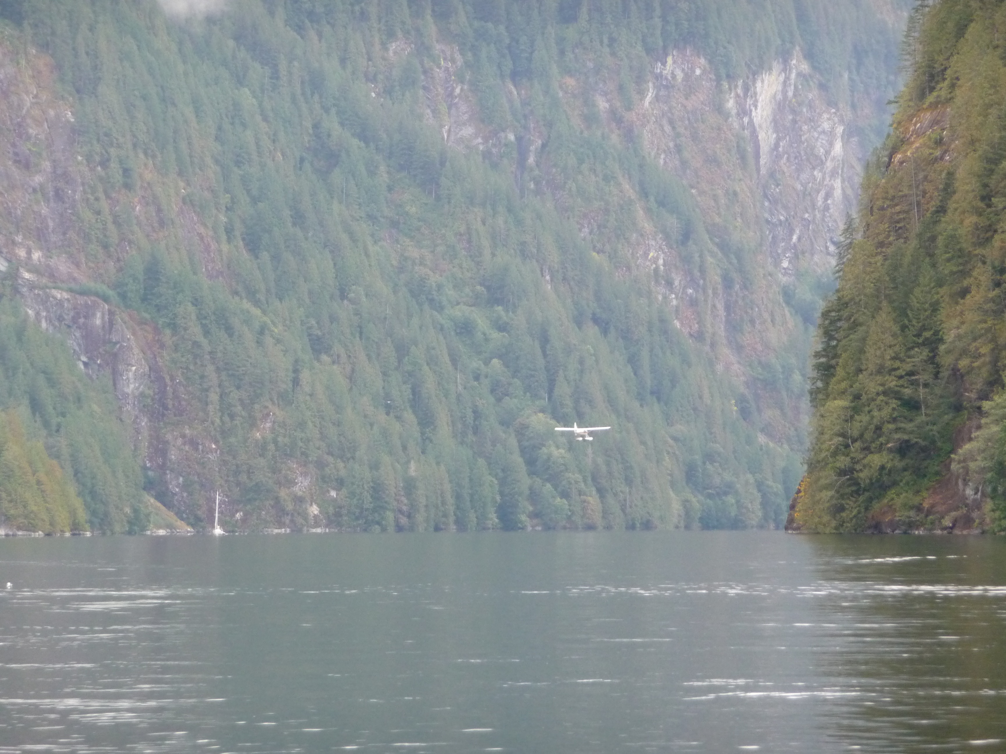
and is very friendly, as is other boaters tied to the dock. A
seaplane from Kenmore Air flew in to drop off passengers next to a
mega-yacht that was anchored.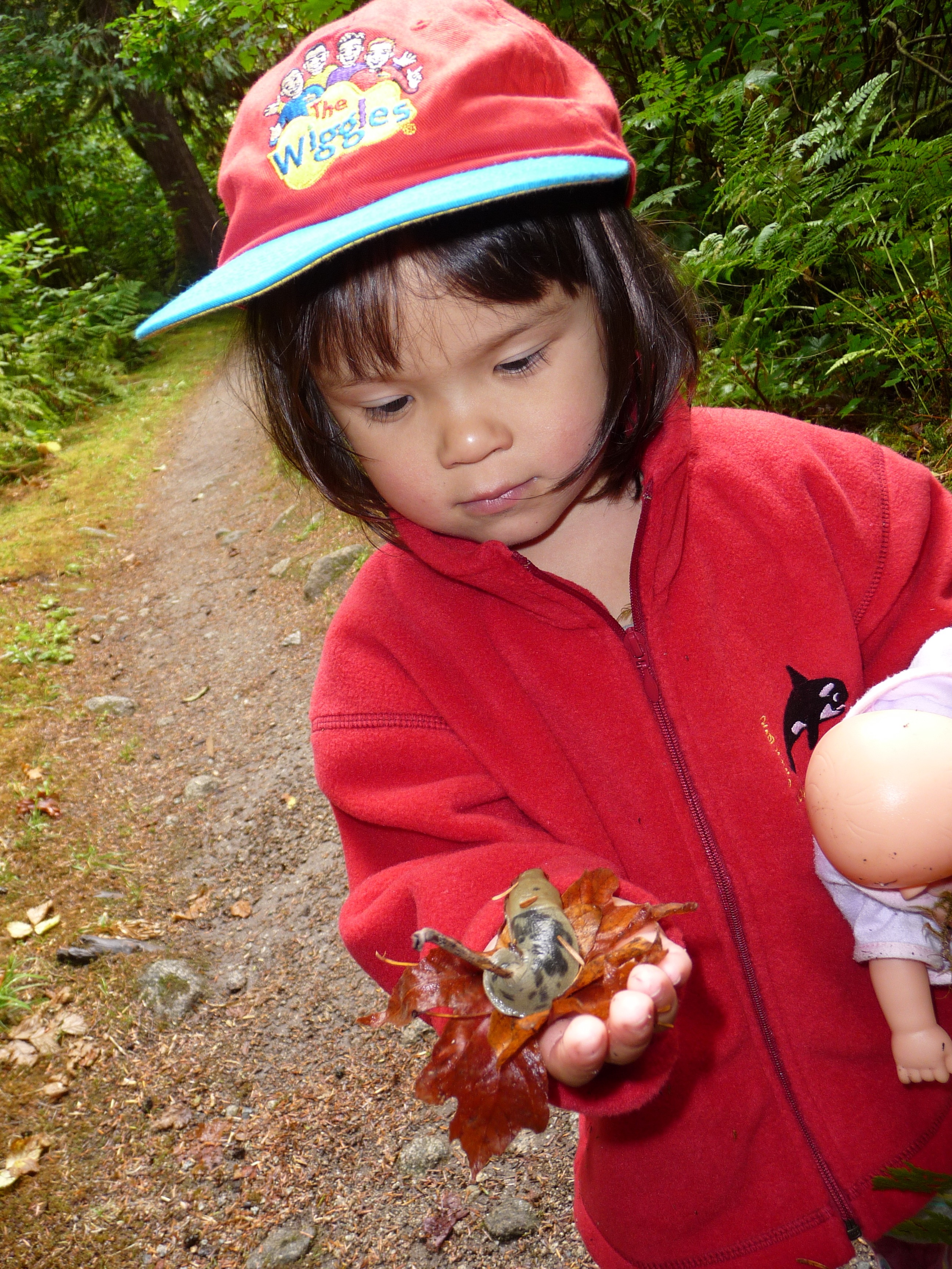
Day 11: Princess Louisa Inlet to Thunder Bay (47nm)
Motored 8 hours in
mostly sunny
skies, no wind, and flat water. To think that 2 days ago a
steady 15 knot wind blew up Jarvis Inlet and motoring against that
would not have be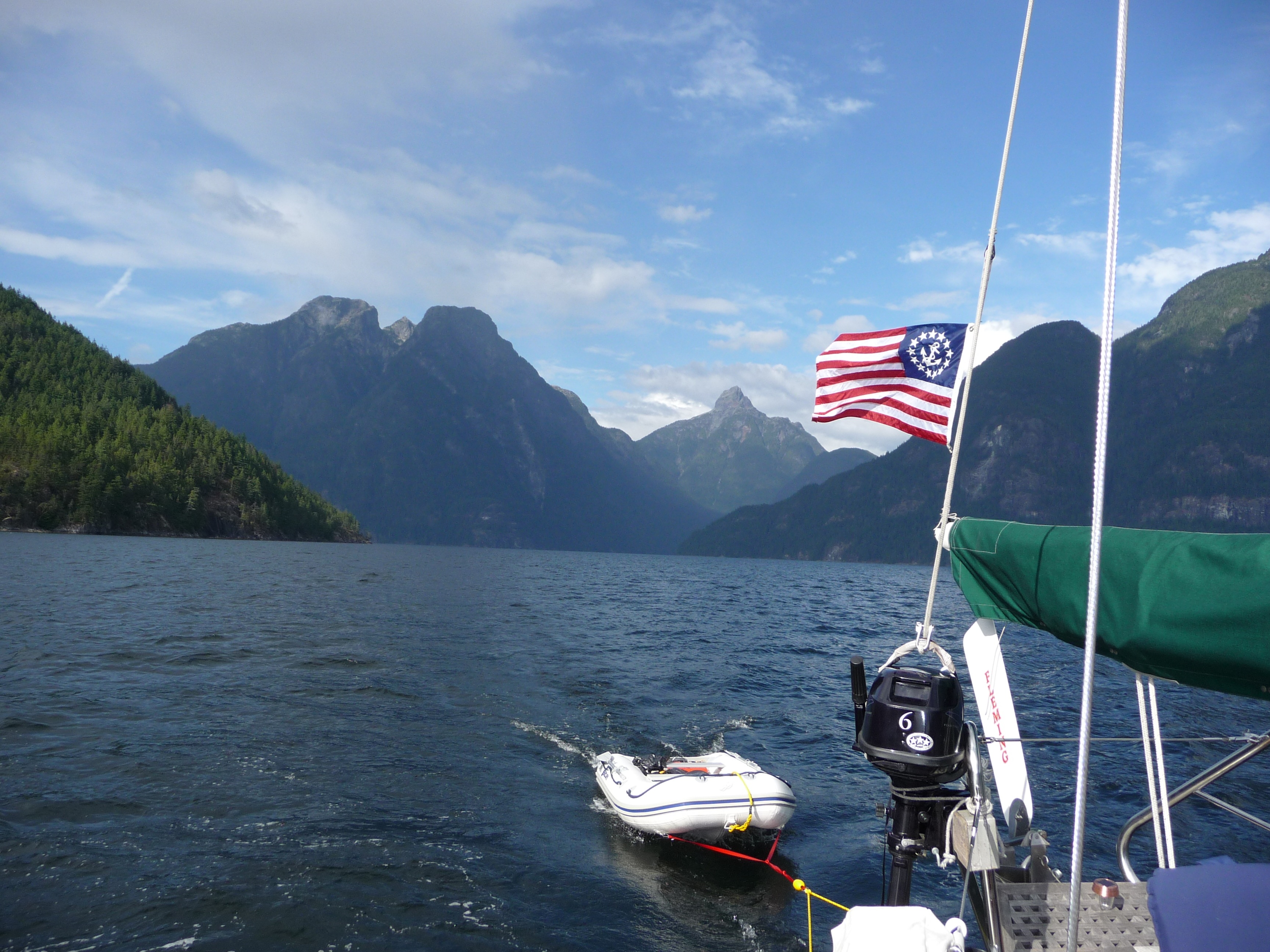
 en
fun. Other
than enjoying
the scenery, not much to do in the cockpit. On long passages
Karen and Jacintha spend a lot of time in the cabin--preparing meals,
relaxing, napping, reading. Karen relieves me at the helm for
short spells so I can go below and she can get some fresh air.
Our plan is to now get to Desolation Sound as quickly as we
can, so todays 47nm to Thunder Bay would put us half way there.
Thunder Bay is near the entrance where Jervis Inlet joins
Georgia Strait. We anchored in the small cove with summer
cabins along the shore at dusk, and had roast lamb, potatoes, and
salad.
en
fun. Other
than enjoying
the scenery, not much to do in the cockpit. On long passages
Karen and Jacintha spend a lot of time in the cabin--preparing meals,
relaxing, napping, reading. Karen relieves me at the helm for
short spells so I can go below and she can get some fresh air.
Our plan is to now get to Desolation Sound as quickly as we
can, so todays 47nm to Thunder Bay would put us half way there.
Thunder Bay is near the entrance where Jervis Inlet joins
Georgia Strait. We anchored in the small cove with summer
cabins along the shore at dusk, and had roast lamb, potatoes, and
salad.
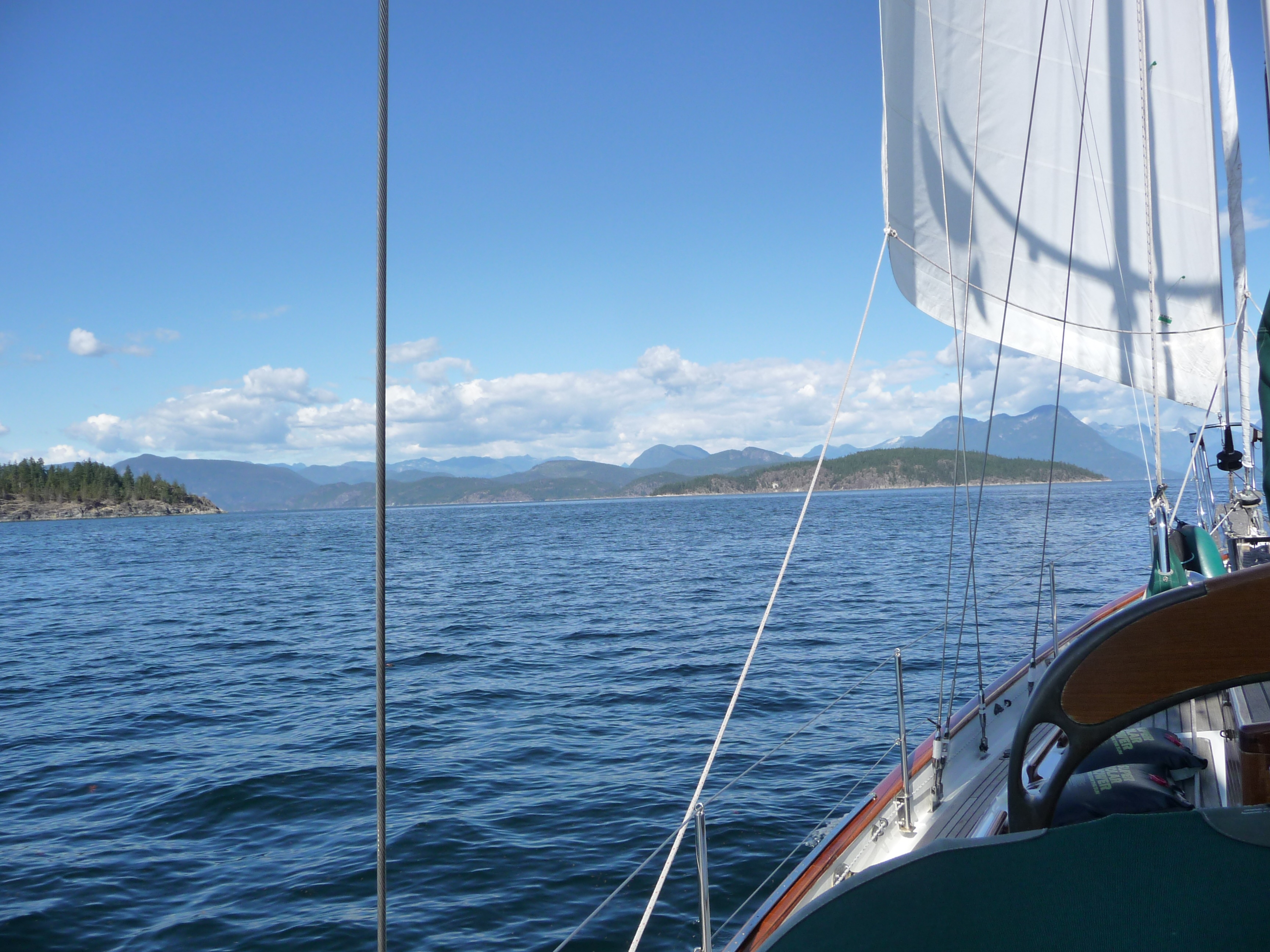
Day
12: Thunder Bay to Redonda Island (42nm)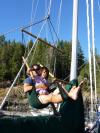
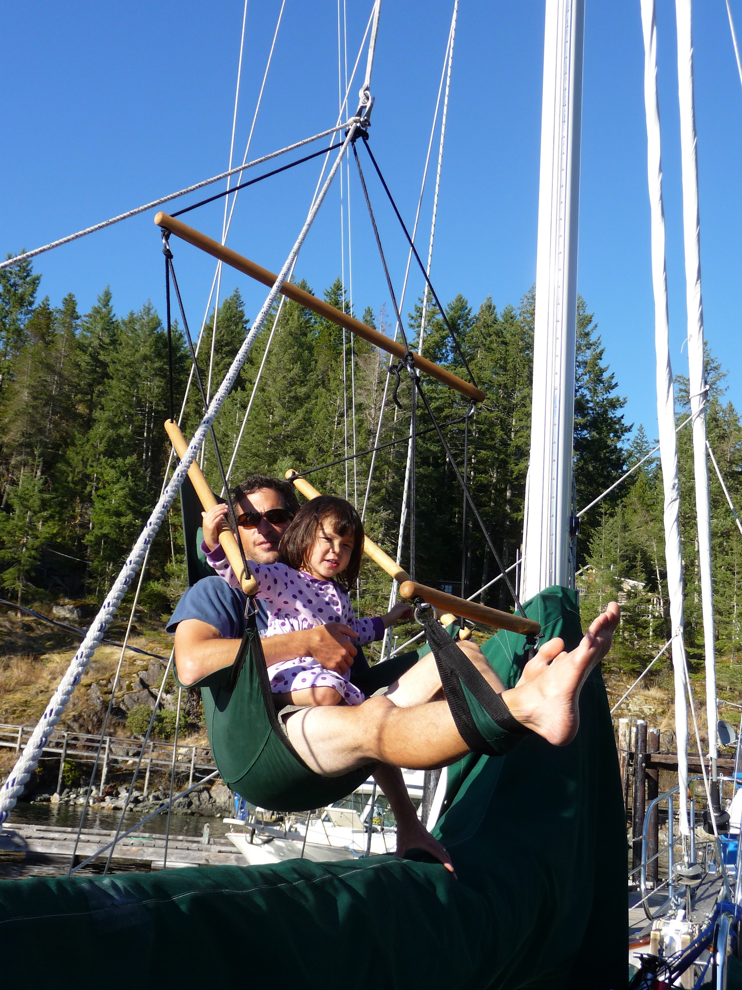
Woke up early to a thick fog. Upanchored and motored along using GPS and Radar to "see" the shoreline. Once out into Georgia Strait, the fog lifted and we motor-sailed another 42nm to Desolation Sound. The wind picked up as we neared Redonda Island. Decided to stay at Refuge Cove on the south-west side of the island. There's a small grocery store and a cafe along the shore. Spent the rest of the day relaxing in the swing chair on the main halyard and doing miscellaneous boat chores. Lamb leftovers for dinner.
Day 13: Redonda Island to Prideaux Haven (16nm)
Ate fried bacon & egg breakfast sandwiches at the cafe while talking with another couple who

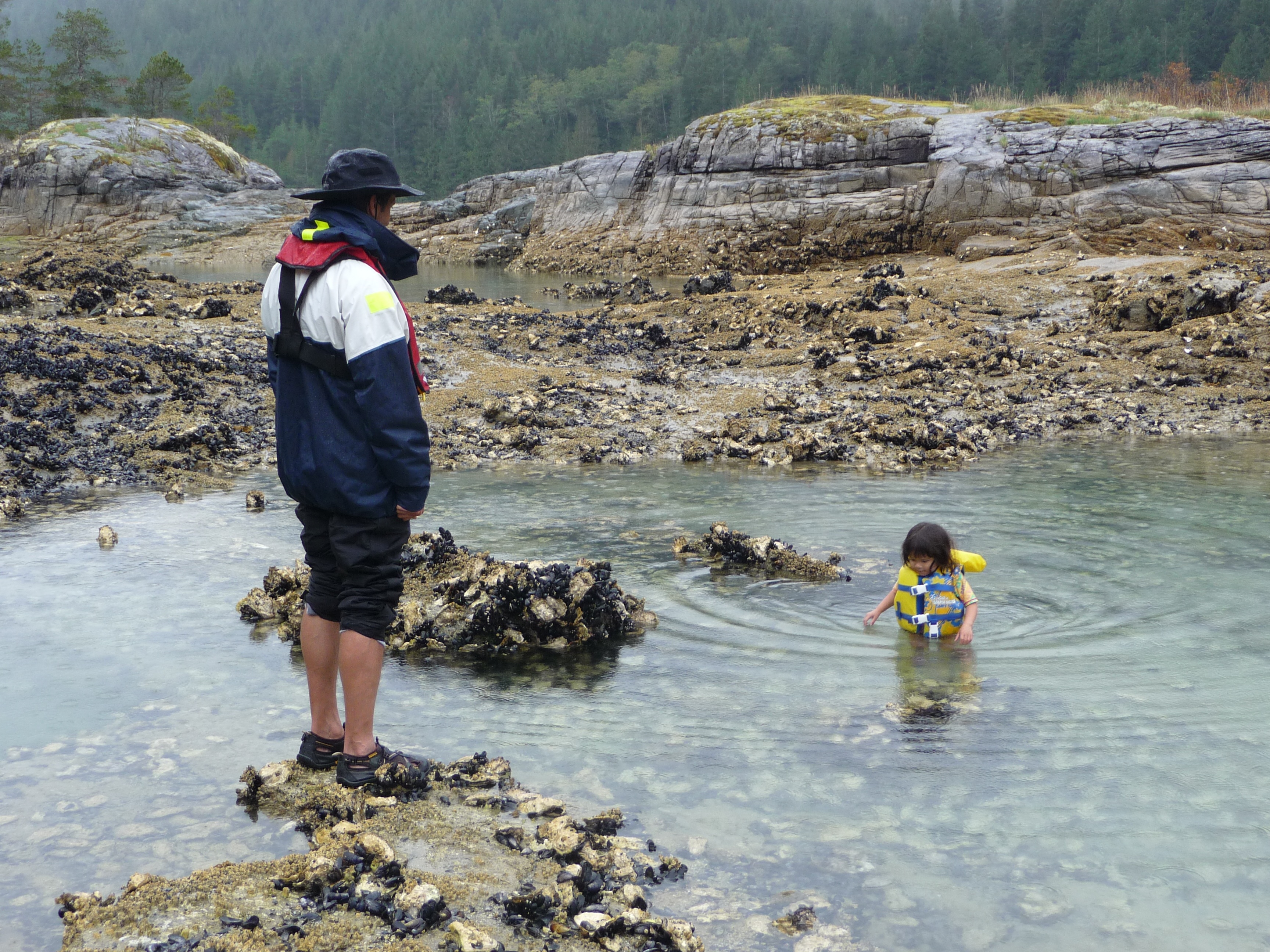
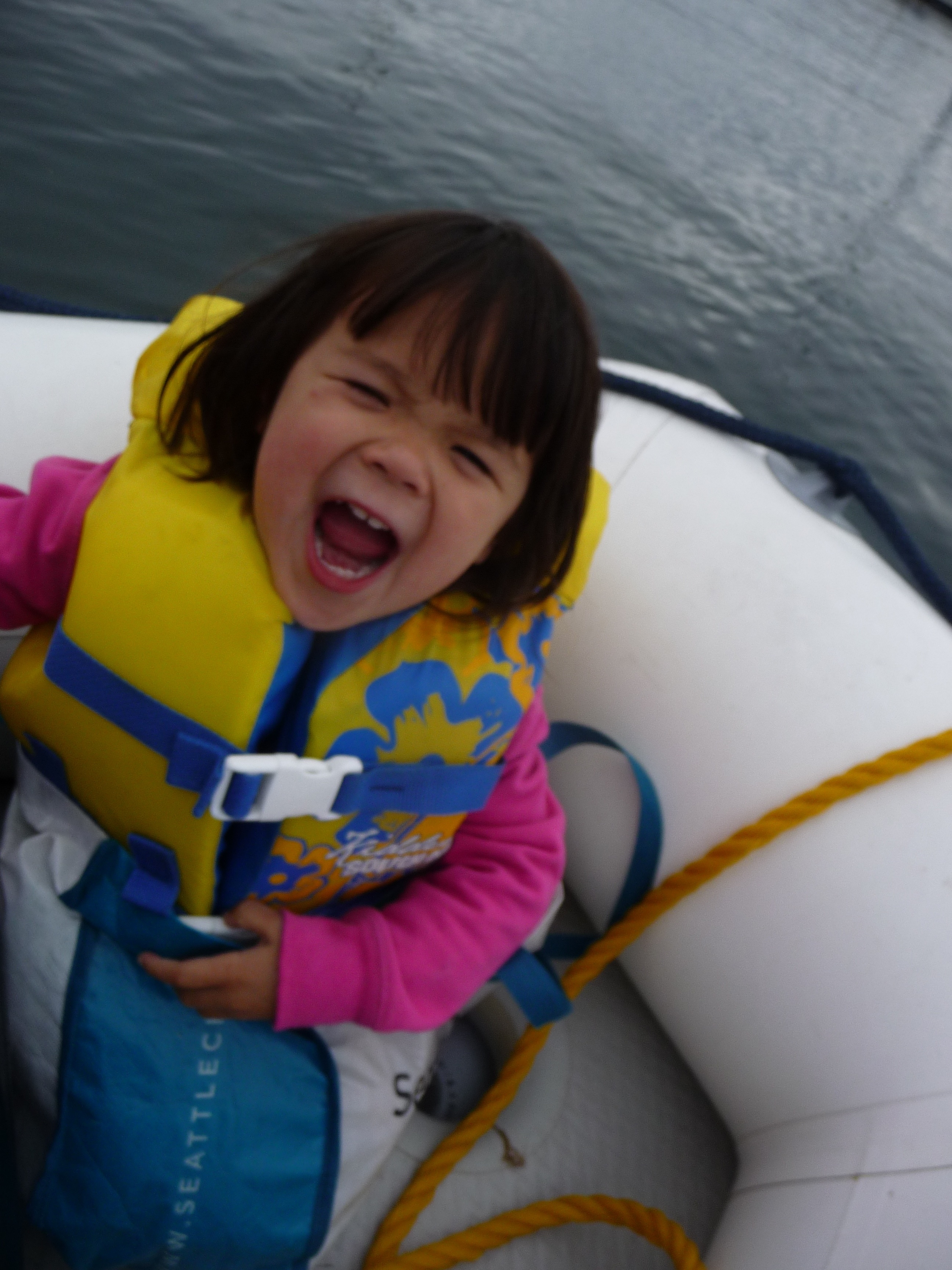
were cruising with their 3 year old also. They were on a 29' boat and lived at a campground on a nearby island. Departed late morning for a sail to an area called Prideaux Haven, which is on the British Columbia mainland. It's a couple of long, narrow channels of water that are protected by long, narrow islands. Had a nice sail getting there with 10-15 knot winds. Dropped anchor inside Prideaux Cove, then went for a dinghy ride between rain showers. After taking 2 or 3 pictures of Jacintha in the dinghy where she either blinked or was looking down at the water, I told her to keep her eyes open for the next picture which resulted in this picture! Our plan is to spend several days here exploring, hiking, and relaxing. We heard this place is very popular (and crowded) in August, but only a few boat here this time of year.
Day 14: Prideaux Haven
Went for a dinghy
ride and spotted
another Hans Christian anchored about a half mile away.
We
saw a
away.
We
saw a man aboard and pulled along-side to chat. We were
invited on board to take a look at his boat. His name was
Klaus and he was in his early 70s. He bought his boat on Lake
Union new back in 1981 and sailed it to the South Pacific and back.
He told us he lived on Quadra Island and sails by himself
every year for about a month. As we were talking, he suddenly
became confused and dis0riented and didn't know where he was or how he
got here. We brought him back to Apropos in our dinghy and
gave him some hot tea and scones and discussed taking him back to
Quadra, about a full day away. After about 30 minutes, Klaus
got his memory back and felt better and no longer wanted to go back
home. Karen's diagnosis was a TIA or mini-stroke and we
recommended he get to a hospital asap. Since he didn't want
to go, we told him we would sail along-side him for the next couple of
days and eventually see that he makes it to his home on Quadra Island.
Since it was only noon, I took him back to his boat and we
planned on meeting in a few hours to go hiking. A few hours
later between rain showers, we met Klaus at Melanie Cove and hiked to
Laura Cove, about an hour away. This was not an easy hike for
an adult and especially for a 3 year old, and became a
scramble over logs and steep, muddy terrain. Captain 'pack horse'
ended up carrying Jacintha most of the way there and all of the way
back since she fell asleep at the half way mark. Klaus was
definitely back to his old self and said he felt great. We
went back to the boat with plans on departing early the next morning
with Klaus on s/v Meriposa along-side.
man aboard and pulled along-side to chat. We were
invited on board to take a look at his boat. His name was
Klaus and he was in his early 70s. He bought his boat on Lake
Union new back in 1981 and sailed it to the South Pacific and back.
He told us he lived on Quadra Island and sails by himself
every year for about a month. As we were talking, he suddenly
became confused and dis0riented and didn't know where he was or how he
got here. We brought him back to Apropos in our dinghy and
gave him some hot tea and scones and discussed taking him back to
Quadra, about a full day away. After about 30 minutes, Klaus
got his memory back and felt better and no longer wanted to go back
home. Karen's diagnosis was a TIA or mini-stroke and we
recommended he get to a hospital asap. Since he didn't want
to go, we told him we would sail along-side him for the next couple of
days and eventually see that he makes it to his home on Quadra Island.
Since it was only noon, I took him back to his boat and we
planned on meeting in a few hours to go hiking. A few hours
later between rain showers, we met Klaus at Melanie Cove and hiked to
Laura Cove, about an hour away. This was not an easy hike for
an adult and especially for a 3 year old, and became a
scramble over logs and steep, muddy terrain. Captain 'pack horse'
ended up carrying Jacintha most of the way there and all of the way
back since she fell asleep at the half way mark. Klaus was
definitely back to his old self and said he felt great. We
went back to the boat with plans on departing early the next morning
with Klaus on s/v Meriposa along-side.
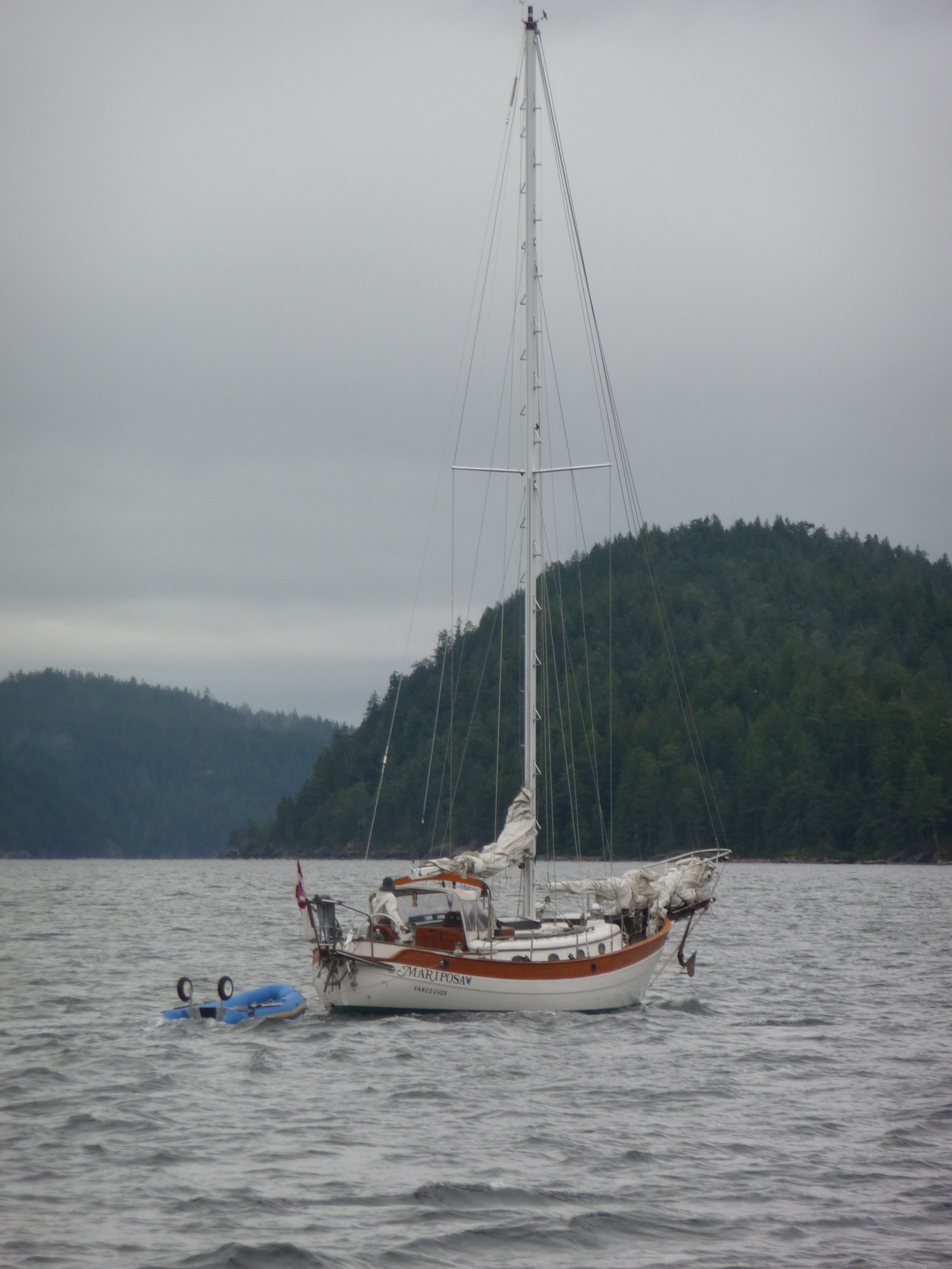
Day 15: Prideaux Haven to E. Redonda Island (10nm)

 By
the time we
up-anchored, s/v Mariposa was waiting for us at the channel entrance
and Klaus said "I'm all better" with a big smile
on his face.
Sailing was clearly his passion. We had a short
sail to Walsh Cove on East Redonda Island. We dropped anchor
in 75'
of
water and put out 200' of chain. It was raining so we put on
rain
gear and dingheyed to a small islet where Jacintha insisted on going in
the water . We had heard that water temperatures are warm
enough for swimming around Desolation Sound because the water doesn't
move much with tidal changes. Compared to the water around
the San Juan Islands, it is warmer in Desolation Sound, but on a chilly
& rainy September day, not very comfortable for swimming.
Nonetheless, Jacintha put on her swim suite and life jacket
and waded in up to her waist while we watched from a safe distance.
Karen took her back to the boat for a hot shower when she
started turning blue. I had read about some Indian
pictographs in the area so Klaus and I went exploring and found some
high up on a rock wall overlooking the channel. We invited
Klaus over for spaghetti carbonara and red wine. It
was very rainy and windy overnight and became apparent that our anchor
was sitting on a rock bottom. The sound of the chain scraping
the rock bottom traveled up to the boat and made it hard to sleep.
We always snubber the chain rode to take the pressure off the
windlass, but it would have been better to snub it from the bowsprit to
slacken the chain completely. Another problem we had was
getting the diesel stove to stay lit due to the wind. A
different stove-pipe end (H shaped) is supposed to be better on windy
days.
By
the time we
up-anchored, s/v Mariposa was waiting for us at the channel entrance
and Klaus said "I'm all better" with a big smile
on his face.
Sailing was clearly his passion. We had a short
sail to Walsh Cove on East Redonda Island. We dropped anchor
in 75'
of
water and put out 200' of chain. It was raining so we put on
rain
gear and dingheyed to a small islet where Jacintha insisted on going in
the water . We had heard that water temperatures are warm
enough for swimming around Desolation Sound because the water doesn't
move much with tidal changes. Compared to the water around
the San Juan Islands, it is warmer in Desolation Sound, but on a chilly
& rainy September day, not very comfortable for swimming.
Nonetheless, Jacintha put on her swim suite and life jacket
and waded in up to her waist while we watched from a safe distance.
Karen took her back to the boat for a hot shower when she
started turning blue. I had read about some Indian
pictographs in the area so Klaus and I went exploring and found some
high up on a rock wall overlooking the channel. We invited
Klaus over for spaghetti carbonara and red wine. It
was very rainy and windy overnight and became apparent that our anchor
was sitting on a rock bottom. The sound of the chain scraping
the rock bottom traveled up to the boat and made it hard to sleep.
We always snubber the chain rode to take the pressure off the
windlass, but it would have been better to snub it from the bowsprit to
slacken the chain completely. Another problem we had was
getting the diesel stove to stay lit due to the wind. A
different stove-pipe end (H shaped) is supposed to be better on windy
days.
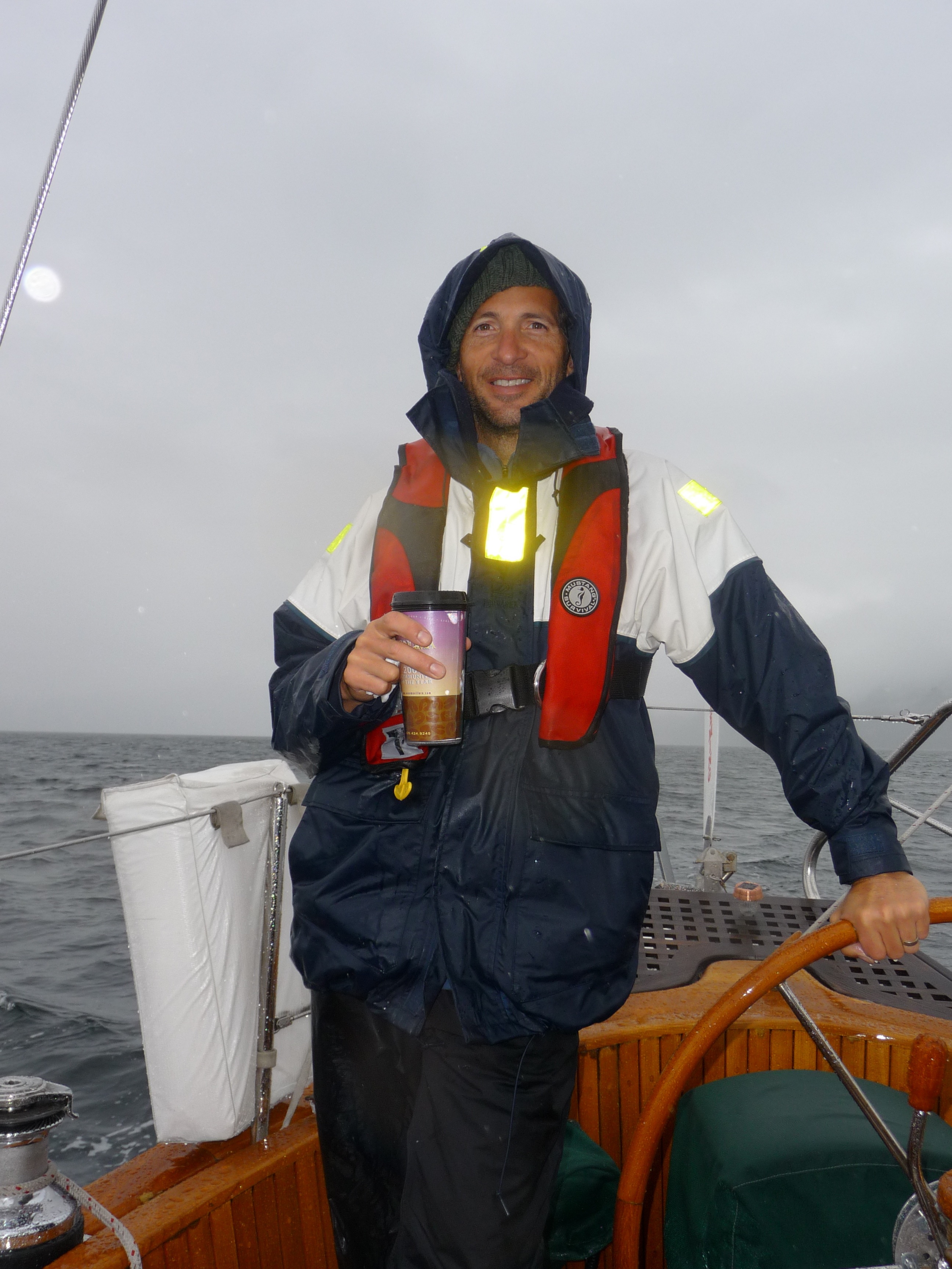
Day
16: E. Redonda Island to Cortes Island (25nm)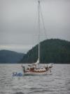
 Up
anchored and motor-sailed along with s/v
Mariposa on a cool, rainy day. Karen supplied me with hot
coffee and clam chowder that
helped keep me warm. Since Klaus was single-handed, we pulled
along side him and used a long extended boat hook to hand him a hot
bowl
of chowder that we put inside a sealed bowl and placed in a bag.
After 5 hours, we reached Cortes Island. Gorge
Marina was a very nice marina that had recently been updated with new
docks, swimming pool, and hot tub. There was also a general
store, restaurant, and laundry facilities. Jacintha had a lot
of fun jumping in the pool with her floatie suite on and the hot tub
overlooking the harbor was fantastic. Had a nice dinner at
the dockside restaurant but Jacintha fell asleep before the food
arrived.
Up
anchored and motor-sailed along with s/v
Mariposa on a cool, rainy day. Karen supplied me with hot
coffee and clam chowder that
helped keep me warm. Since Klaus was single-handed, we pulled
along side him and used a long extended boat hook to hand him a hot
bowl
of chowder that we put inside a sealed bowl and placed in a bag.
After 5 hours, we reached Cortes Island. Gorge
Marina was a very nice marina that had recently been updated with new
docks, swimming pool, and hot tub. There was also a general
store, restaurant, and laundry facilities. Jacintha had a lot
of fun jumping in the pool with her floatie suite on and the hot tub
overlooking the harbor was fantastic. Had a nice dinner at
the dockside restaurant but Jacintha fell asleep before the food
arrived.

Day
17: Cortes Island to Quadra Island (11nm)
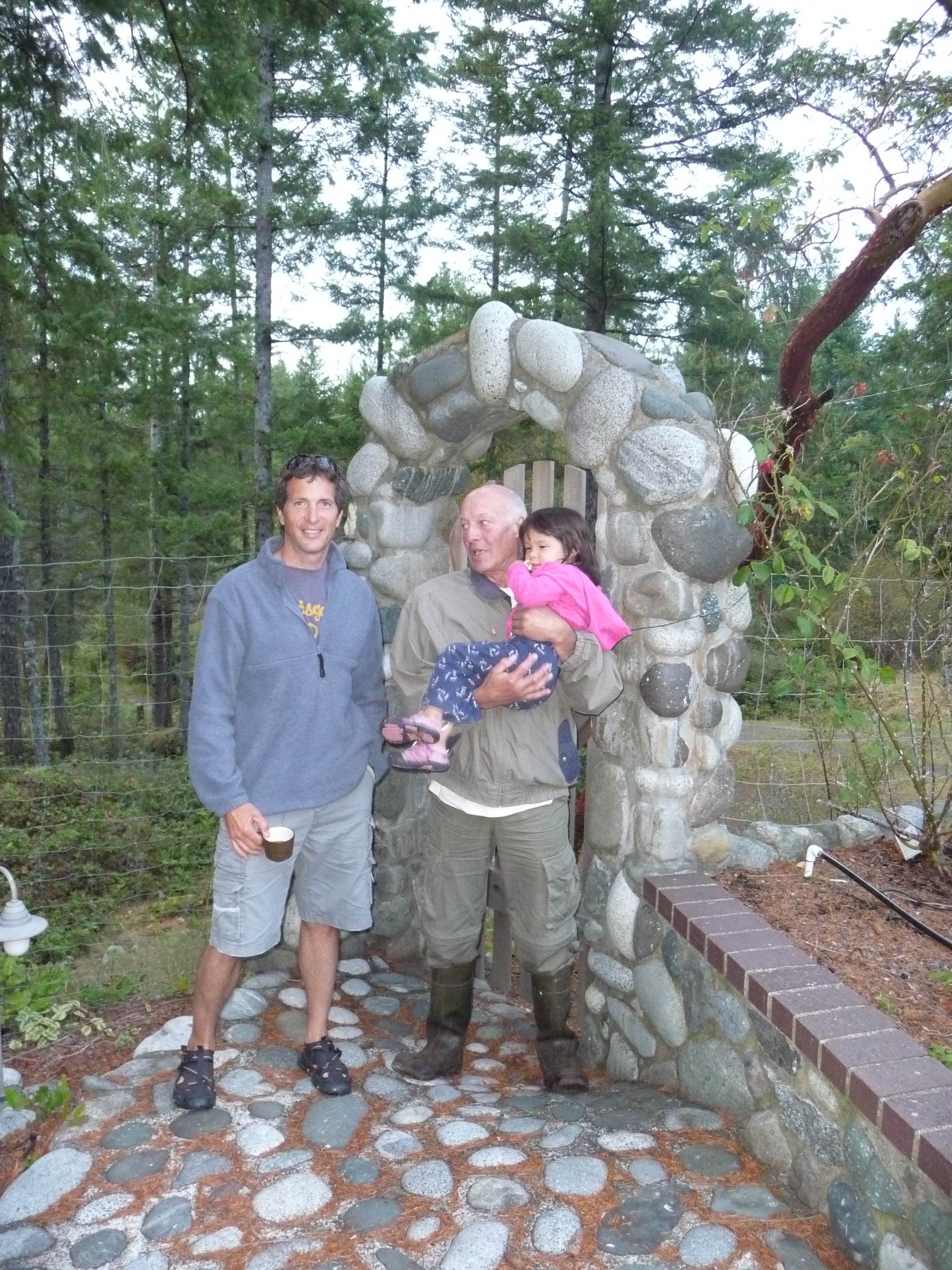
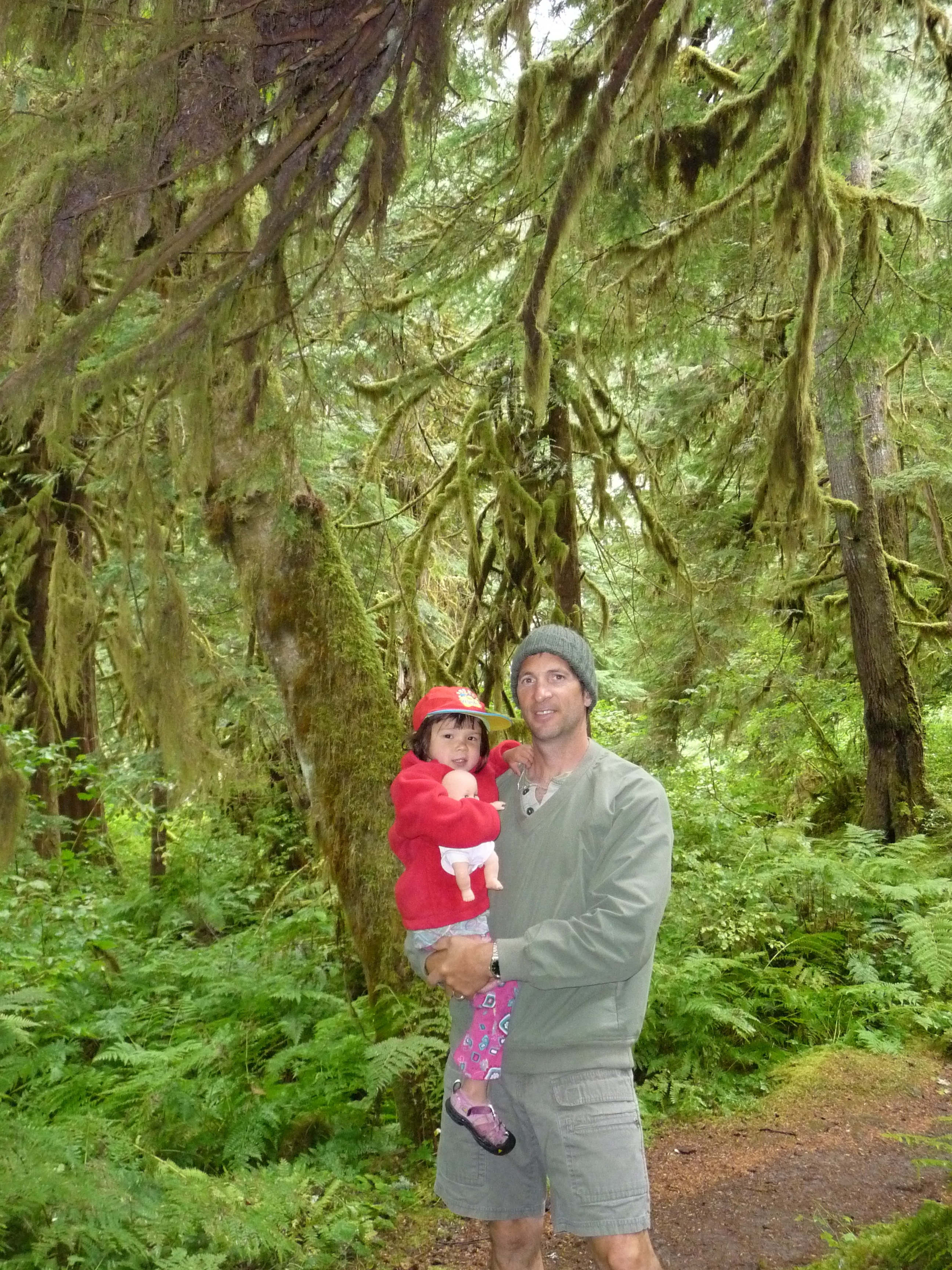
Nice sunny day, but not enough wind for sailing as we departed Cortes Island. We followed Klaus to a protected bay on Quadra Island and tied along-side s/v Mariposa. Klaus uses a mooring ball with 2 stern ties to shore to secure his boat, then takes his dinghy to shore and walks a short distance to his house. Since Jacintha just went down for a nap, Klaus gave us directions for getting to his house and we would meet there later. Once we got to his house, Klaus took me around his property which has breathtaking views of Hoskyn Channel. Karen and Jacintha stayed behind with Mita, Klaus's wife, who was preparing dinner. Klaus was a master stone mason and did most of the construction of the house including a two-story, 5-sided brick fireplace hearth and outside a stone arched gate entrance. After a wonderful meal, we hiked back to the boat with departing gifts of banana bread, plums, Chanterell mushrooms, and toys for Jacintha. Klaus had promised to see a doctor the following day. [note--we keep in touch with Klaus and Mita and they are both in good health. His doctors agreed that he probably had a TIA while we were with him on his boat.]
Day
18: Quadra Island to Lasqueti Island (63nm)
 With
250 miles to get back to Seattle over 5 days, we planned on averaging
50nm per day. Winds were light again today but we managed to
motor all the way to Lasqueti Island, right next door to Texado Island.
Not much to do along the way aside from keeping watch for
other boats and enjoying the scenery. After 10 hours of
motoring, we dropped anchor in Boho Cove, which was quiet and
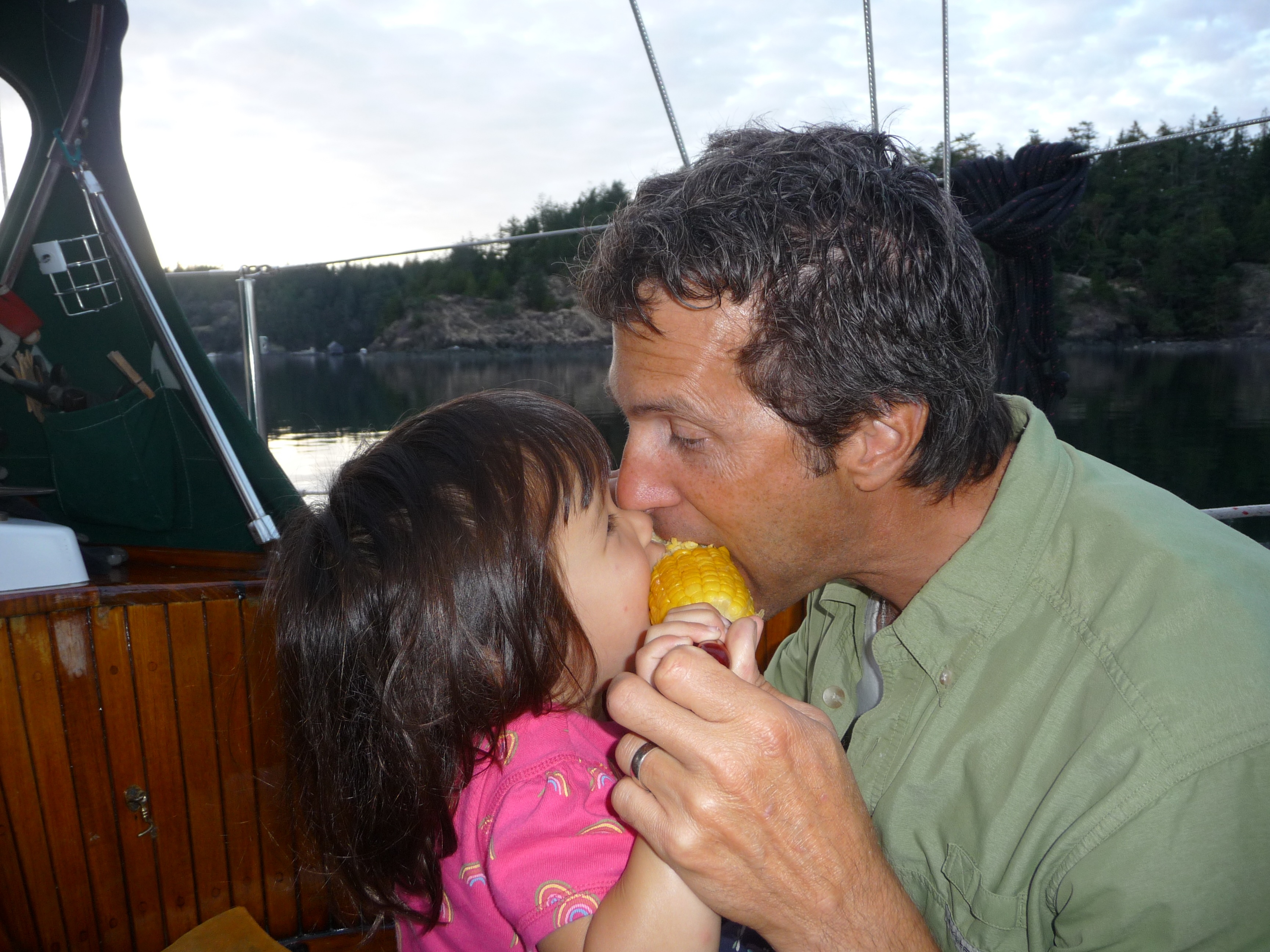
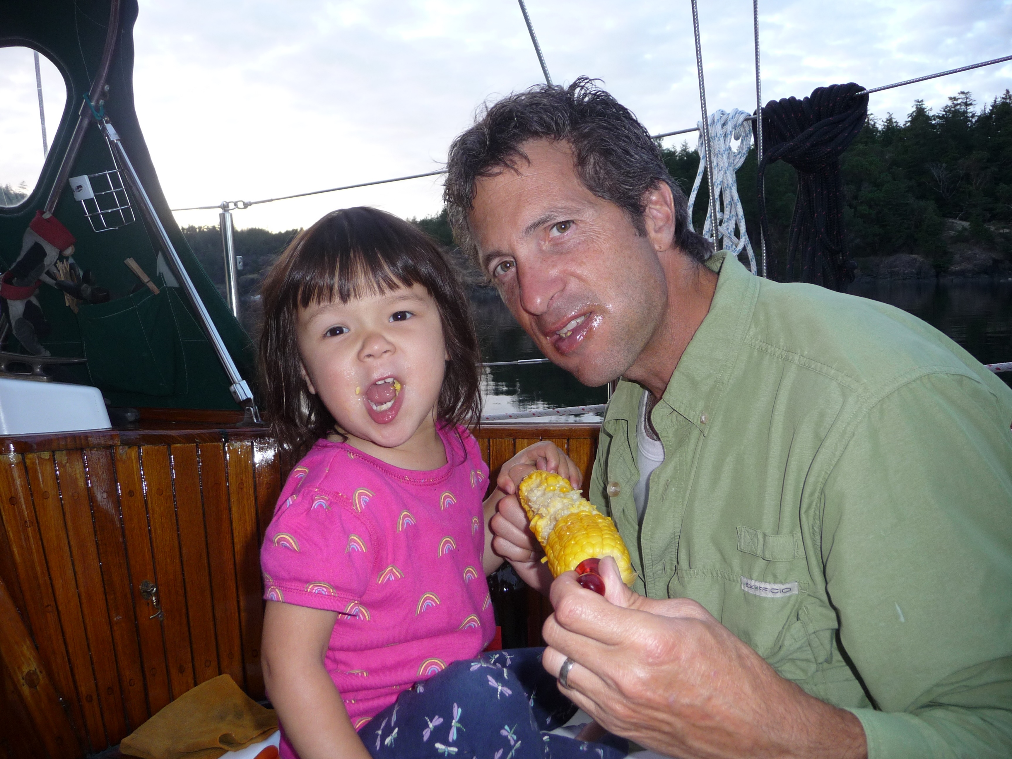
well-protected. Grilled steaks and corn for dinner--Jacintha
and I shared the last ear! Later we went ashore and explored.
With
250 miles to get back to Seattle over 5 days, we planned on averaging
50nm per day. Winds were light again today but we managed to
motor all the way to Lasqueti Island, right next door to Texado Island.
Not much to do along the way aside from keeping watch for
other boats and enjoying the scenery. After 10 hours of
motoring, we dropped anchor in Boho Cove, which was quiet and
well-protected. Grilled steaks and corn for dinner--Jacintha
and I shared the last ear! Later we went ashore and explored.

Day 19: Lasqueti Island to Vancouver (58nm)

Up-anchored at 7:30am and got under way with the motor until the wind picked up in the middle of Georgia Strait. Got a bit too close to area WG (Whiskey Gulf is a military exercise area that is active on certain days) and a Canadian Coast Guard inflatable sped towards us . Captain 'Don't Fire Unless Fired Upon' slowed the boat and waited for them to come along-side. Turns out they were friendlies and just wanted to make sure we knew that WG was active. Fact is we heard the VHF broadcast earlier and were still outside WG and getting ready to tack. They sped away as fast they approached with their 300HP outboards. The next tack put us on a course for Vancouver, another place we haven't been to before. We anchored inside a very crowded area of False Creek, then drove the dinghy to Granville Island where we met James, Katherine, and kids for dinner. Dinghied back to Apropos in the dark and got to sleep early so we could get another early start the next day.
Day 20: Vancouver to Jones Island (60nm)

 Motored
all day today since winds were very light. We followed the BC
coastline south to Point Roberts, where we cleared customs.
Along the way we went through an area that's supposed to be
one of the best for salmon fishing. There were hundreds of
small fishing boats near the mouth of the Frazer River. On
long
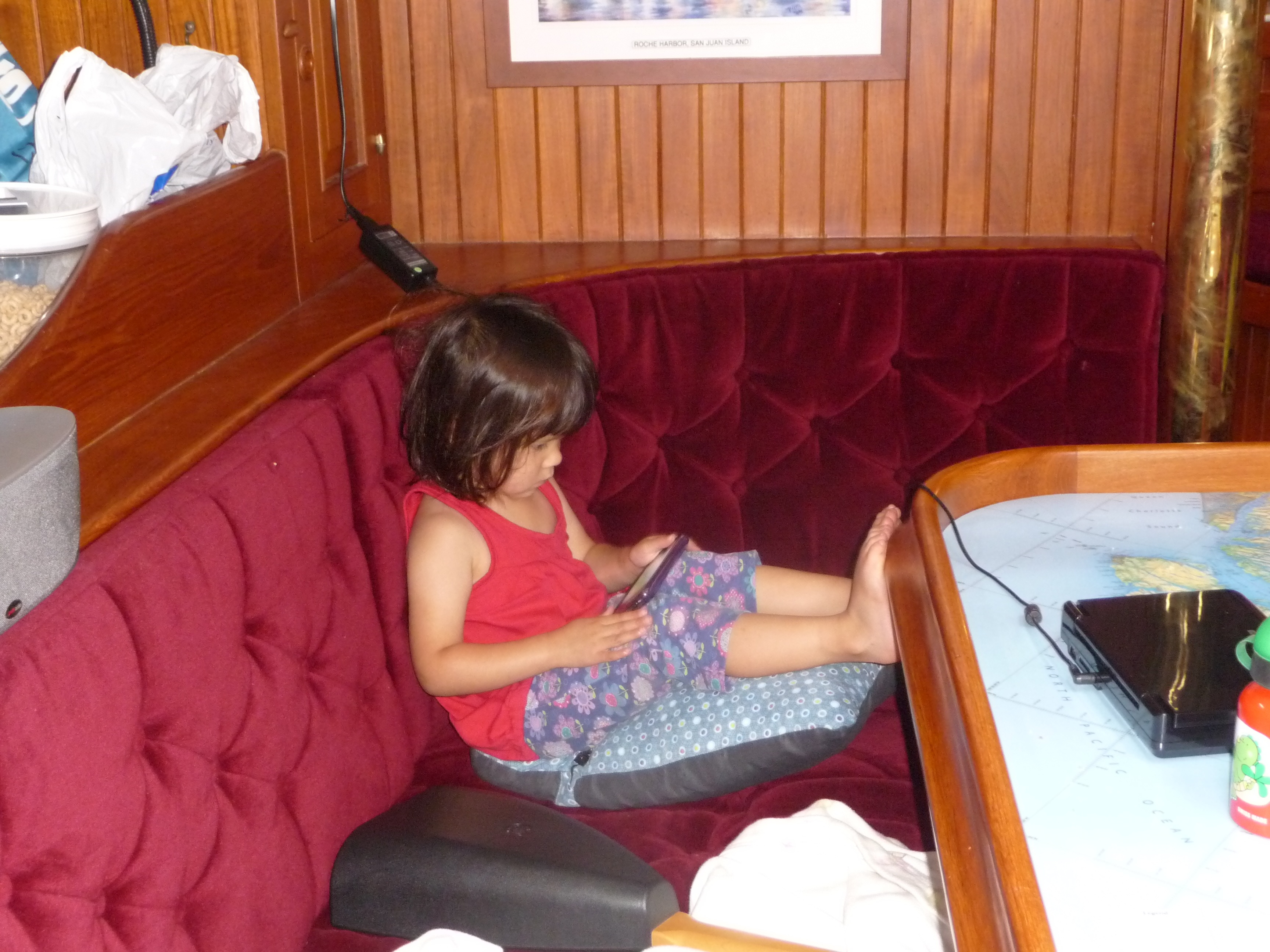
passages, Jacintha finds ways to
pass the time. Watching videos, building "tents", coloring,
playing with Cheerios, and sometimes just making us laugh at the things
she comes up with. By the time we cleared customs, it
was 4pm but we decided to keep going south since it was past high tide
and the current would be flowing south for the next few hours.
My initial plan was to get to Sucia Island, but a strong
current down Presidents Channel made it more advantageous to go to
Jones Island. The last 2 hours were in light rain, thick fog,
and total darkness (the darkness didn't really matter since the fog was
so thick). We had the foghorn sounding a loud bleep every 2
minutes, GPS at the helm, Radar overlayed on GPS at the nav. station,
and 2 sets of fingers crossed. Karen did a great job tracking
the big ships on radar and telling me where they were.
Had to navigate blindly around some partially submerged
islets just to the north of Jones Island. This was definitely
putting faith in electronic charts and a lot of technology.
We were relieved to get into the north bay of Jones Island at
about 11pm, but still not home free. Even though it was
mid-October, it was a Friday night and the perimeter of the bay was
full of anchor lights. Our only choice was to anchor in the
middle of the bay in deep water. We dropped the hook with
200' of chain and a 3:1 scope. Before going to bed, we
determined the best time to leave to avoid fighting a strong flood
current in the San Juan Channel would be 4am!
Motored
all day today since winds were very light. We followed the BC
coastline south to Point Roberts, where we cleared customs.
Along the way we went through an area that's supposed to be
one of the best for salmon fishing. There were hundreds of
small fishing boats near the mouth of the Frazer River. On
long
passages, Jacintha finds ways to
pass the time. Watching videos, building "tents", coloring,
playing with Cheerios, and sometimes just making us laugh at the things
she comes up with. By the time we cleared customs, it
was 4pm but we decided to keep going south since it was past high tide
and the current would be flowing south for the next few hours.
My initial plan was to get to Sucia Island, but a strong
current down Presidents Channel made it more advantageous to go to
Jones Island. The last 2 hours were in light rain, thick fog,
and total darkness (the darkness didn't really matter since the fog was
so thick). We had the foghorn sounding a loud bleep every 2
minutes, GPS at the helm, Radar overlayed on GPS at the nav. station,
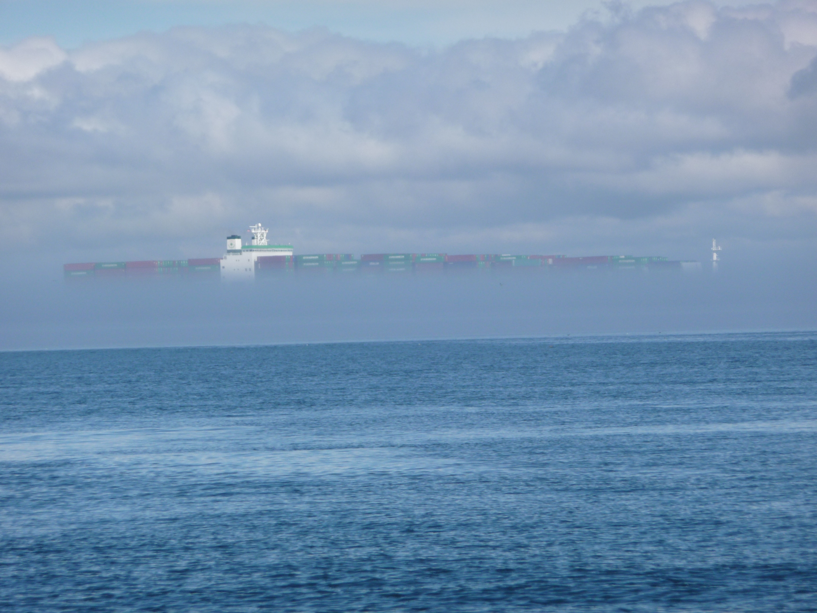
and 2 sets of fingers crossed. Karen did a great job tracking
the big ships on radar and telling me where they were.
Had to navigate blindly around some partially submerged
islets just to the north of Jones Island. This was definitely
putting faith in electronic charts and a lot of technology.
We were relieved to get into the north bay of Jones Island at
about 11pm, but still not home free. Even though it was
mid-October, it was a Friday night and the perimeter of the bay was
full of anchor lights. Our only choice was to anchor in the
middle of the bay in deep water. We dropped the hook with
200' of chain and a 3:1 scope. Before going to bed, we
determined the best time to leave to avoid fighting a strong flood
current in the San Juan Channel would be 4am!
Day 21: Jones Island to Port Townsend (35nm)
 Got
up at 4am and up-anchored in
the dark. The fog was still very thick. Just like
last night, we used radar and GPS to feel our way down San Juan
Channel. Heard the ferry foghorns as we neared Friday Harbor
and passed within a hundred yards without making visual contact.
The fog dissipated and it was getting light by the time we
reached Cattle Point, the entrance to the Strait of Juan de Fuca.
We timed it perfectly, riding the current down San Juan
Channel and reaching Cattle Point at slack. The fog thickened
again out in the strait and didn't lift until we were near Port
Townsend. Karen monitored the radar during the 4 hour
crossing and let me know when ships were approaching. There
were some tense moments where we had to decide which way to go to avoid
getting too close. Ships in the strait travel at over 30
knots so there isn't a lot of time to get out of their way.
At one point there was an eastbound ship coming towards us and
on the other side there was a southbound ship coming from Georgia
Strait, both sounding their foghorns. We were glad to get to
Port Townsend and anchored near the ferry terminal, then took the
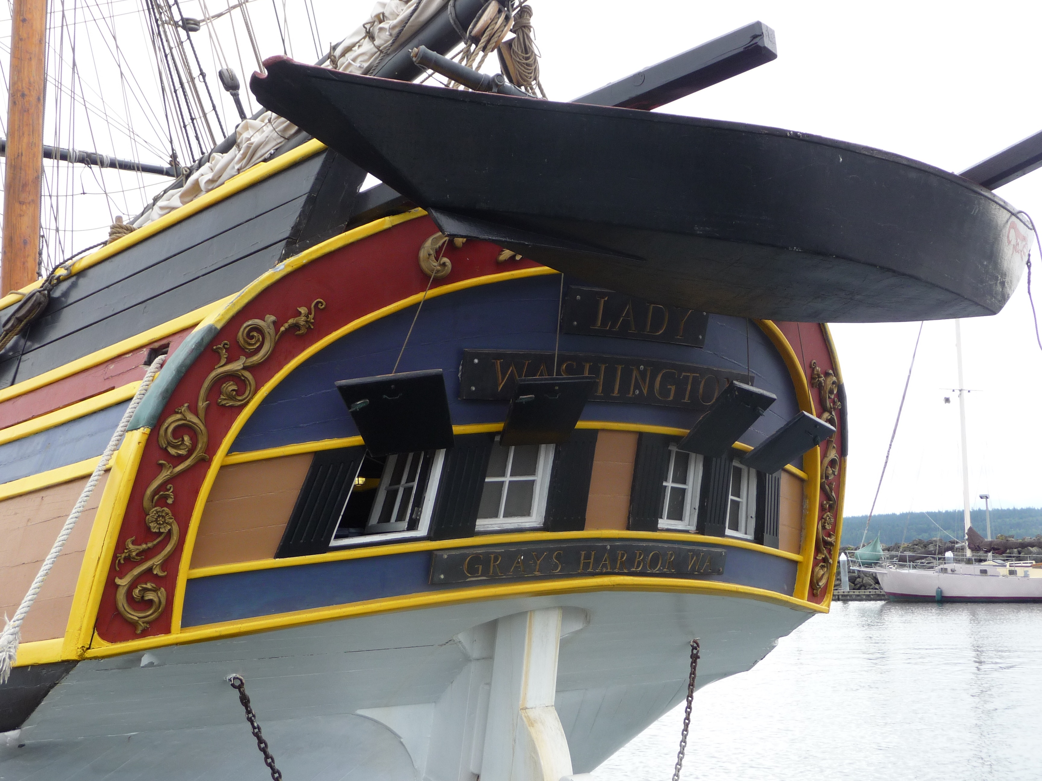
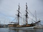
dinghy ashore and had pizza and ice cream. The Lady
Washington was docked nearby. This boat was used in the
Pirates of the Caribbean as the Black Perl.
Got
up at 4am and up-anchored in
the dark. The fog was still very thick. Just like
last night, we used radar and GPS to feel our way down San Juan
Channel. Heard the ferry foghorns as we neared Friday Harbor
and passed within a hundred yards without making visual contact.
The fog dissipated and it was getting light by the time we
reached Cattle Point, the entrance to the Strait of Juan de Fuca.
We timed it perfectly, riding the current down San Juan
Channel and reaching Cattle Point at slack. The fog thickened
again out in the strait and didn't lift until we were near Port
Townsend. Karen monitored the radar during the 4 hour
crossing and let me know when ships were approaching. There
were some tense moments where we had to decide which way to go to avoid
getting too close. Ships in the strait travel at over 30
knots so there isn't a lot of time to get out of their way.
At one point there was an eastbound ship coming towards us and
on the other side there was a southbound ship coming from Georgia
Strait, both sounding their foghorns. We were glad to get to
Port Townsend and anchored near the ferry terminal, then took the
dinghy ashore and had pizza and ice cream. The Lady
Washington was docked nearby. This boat was used in the
Pirates of the Caribbean as the Black Perl.

Day
22: Port Townsend to Lake Union (36nm)
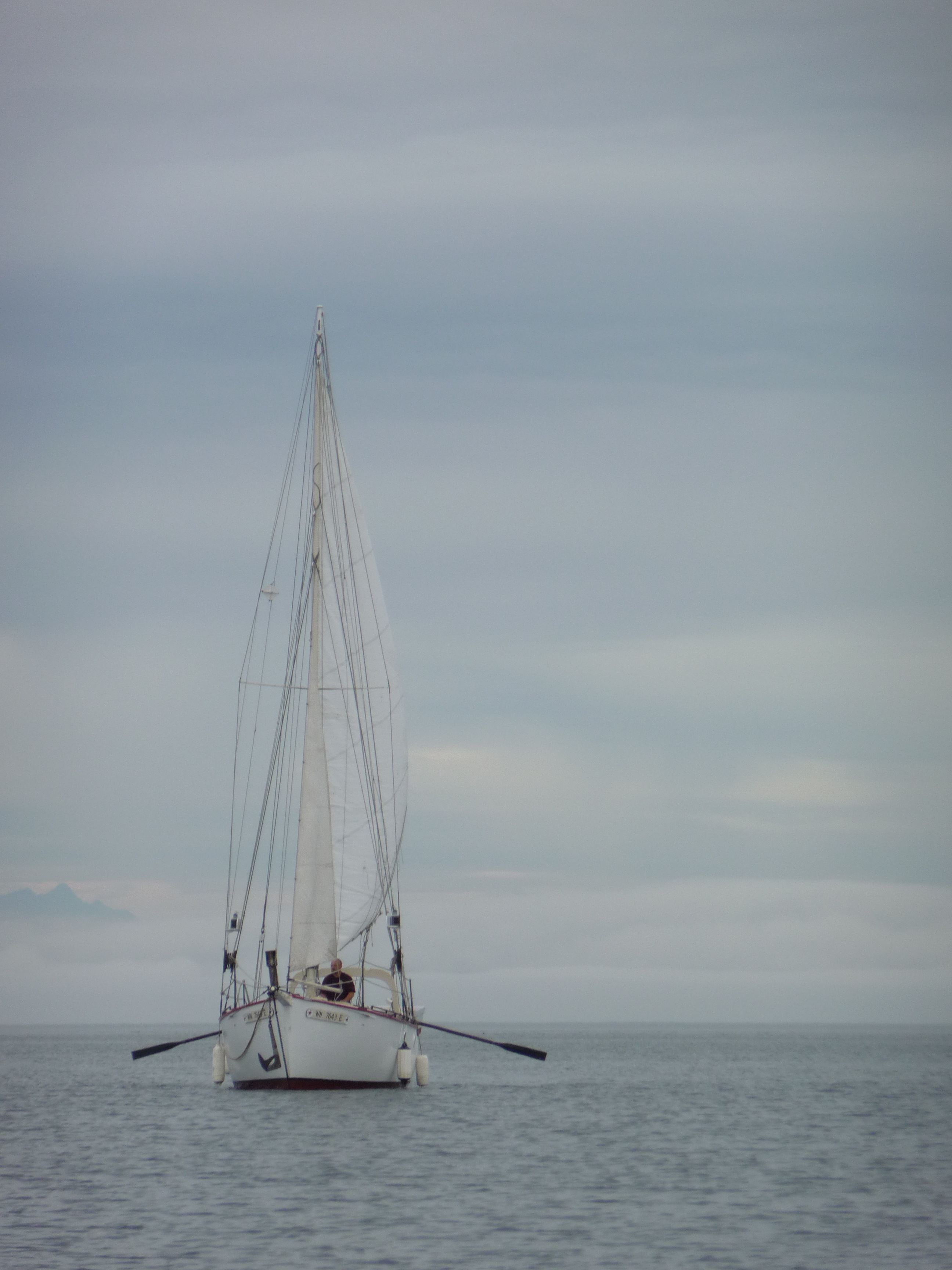
There was no need to leave early since low tide was around noon. We fueled up with 66 gallons of diesel. As we motored from the fuel dock, we saw a man rowing his sailboat with long oars and all sails up. The wind started out light so we motored down Puget Sound taking advantage of a nice flood current. The wind picked up about half way and we were able to get a few hours of sailing in. A short wait at the locks, then motored the final couple of miles to Lake Union to end a fantastic trip.
| Ports visited | 18 |
| Nautical miles | 660 |
| Engine hours | 110 |
| Whales spotted | >20 |